Since we reached Whitehorse there was little wildlife to view all the way to Watson Lake, home of the Sign Post Forest. Leaving our campsite fairly early for us we arrived at Watson Lake where we fueled up.
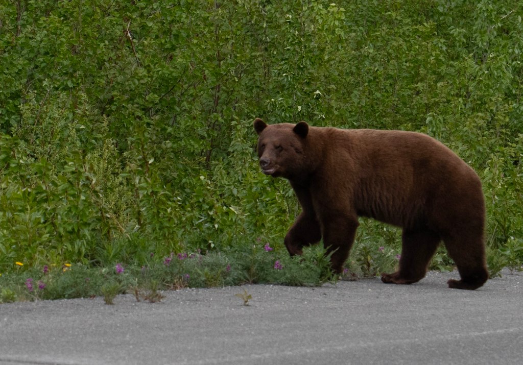
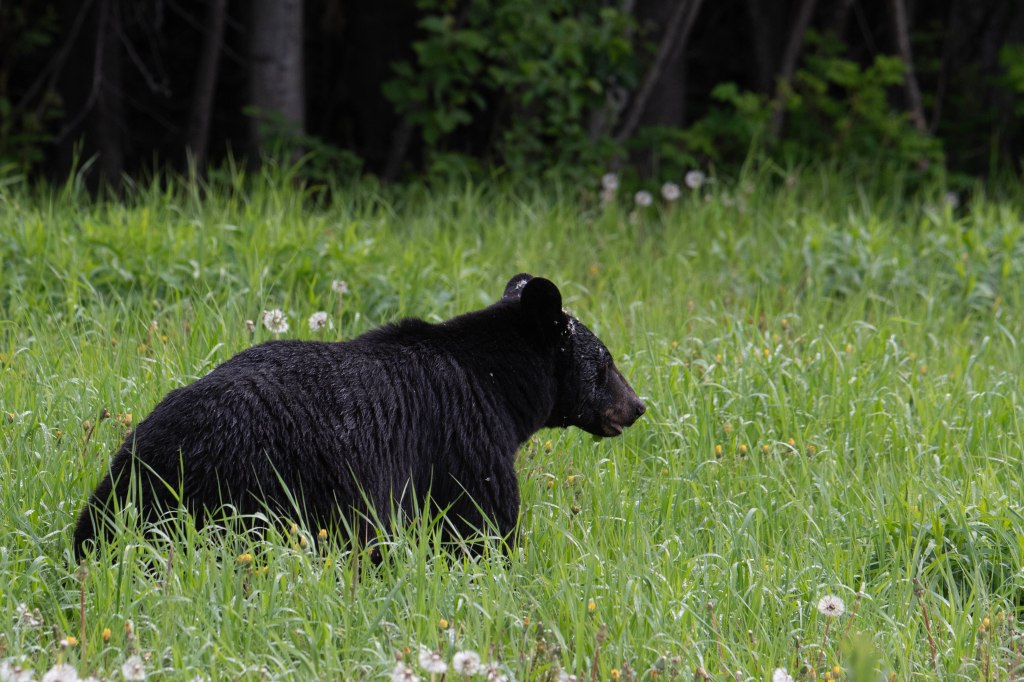
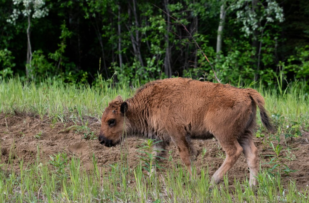
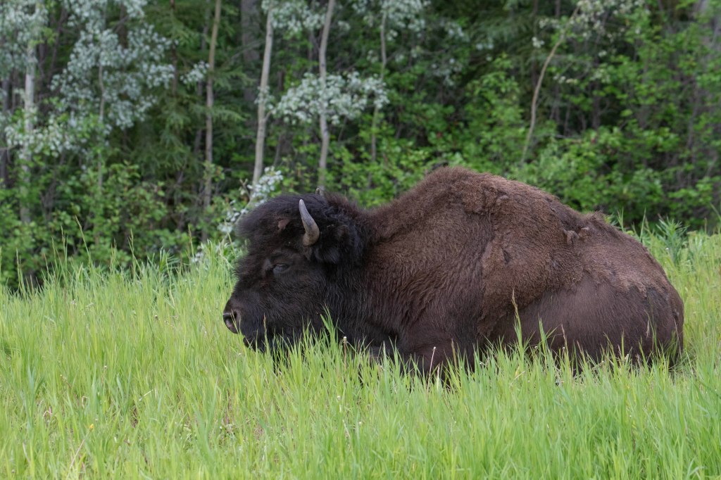
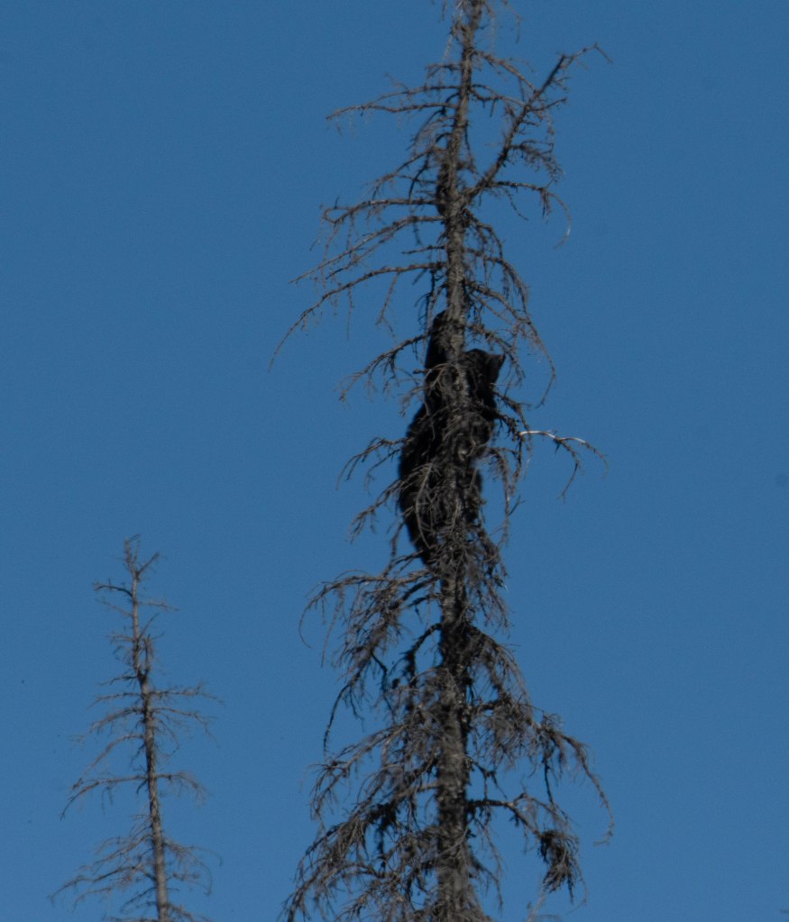
After leaving Watson Lake, we started seeing wildlife, first Snowshoe Hare, then Wood Bison, along with several Black Bears.
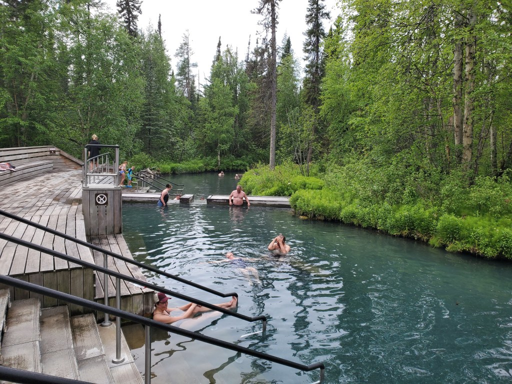
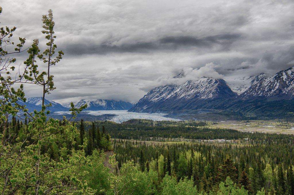
We arrived at Laird Hot Springs to find there was room at the campground, so we ended our travel day around 10:30 am. The afternoon saw us spending a few hours at the hot springs. The entire campground is surrounded with an electric fence to keep bears and moose out. The Park does not have the fence on the quarter mile long boardwalk so one is on the lookout mostly for moose. We enjoyed the relaxing soak along with pleasant conversations with various people there. After a while we were the texture of prunes, so it was time to head back to the campsite. In getting dressed I started chatting with an older guy who was using a cane. He had balance issues and I even thought he would have difficulties in walking the quarter mile boardwalk back to the parking lot and campground. Something about him was familiar. Anyway, as we chatted more he explained he was walking from the Alaska/Yukon border at Beaver Creek the entire length of the of the Alaska Highway and continuing south to the British Columbia/Washington State border. I am not sure how many miles that is, but it is well over 1,000 miles and possibly close to 2,000 miles. The reason he was familiar was that we saw him walking along the highway pushing a cart more than a month ago. This man who could hardly walk well was on a journey. He explained to me that he just put one foot in front of the other.
We broke camp and traveled into town securing water and ice as well as a sanitary dump of our waste tank. Next we retraced our steps from earlier in the week and headed towards Haines Junction. We came across signage for a large bike ride. The Canadian border officer said that the next day a bike ride was scheduled from Haines Junction to Haines. Around 1,500 cyclists were expected. I thought of my more adventurous cycling days and thought this would have been a great ride for me. Not any longer!
Once we arrived in Haines Junction it was lunchtime and we enjoyed shrimp chowder at the café/bakery. Next, it was on to Whitehorse were we supplied for the remaining 1,000 miles or so of the Alaska Highway heading south. We noticed an uptick in RV’s heading north as high tourist season approaches.
We’ve not had the pleasure of a shower in several days so we stopped at Johnson’s Crossing Lodge and RV park where we enjoyed a quiet evening and hot showers in the morning. Life is good!
Our next planned stop was Liard Hot Spring Provincial Park, It the one place along the Alaska Highway that is a must stop. Well, maybe the welcome center at Mile Zero in Dawson City where everybody wants to get a photograph of the Mile Zero sign where many take the obligatory photograph as they start on the Highway.
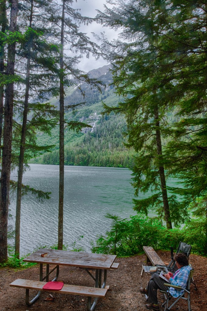
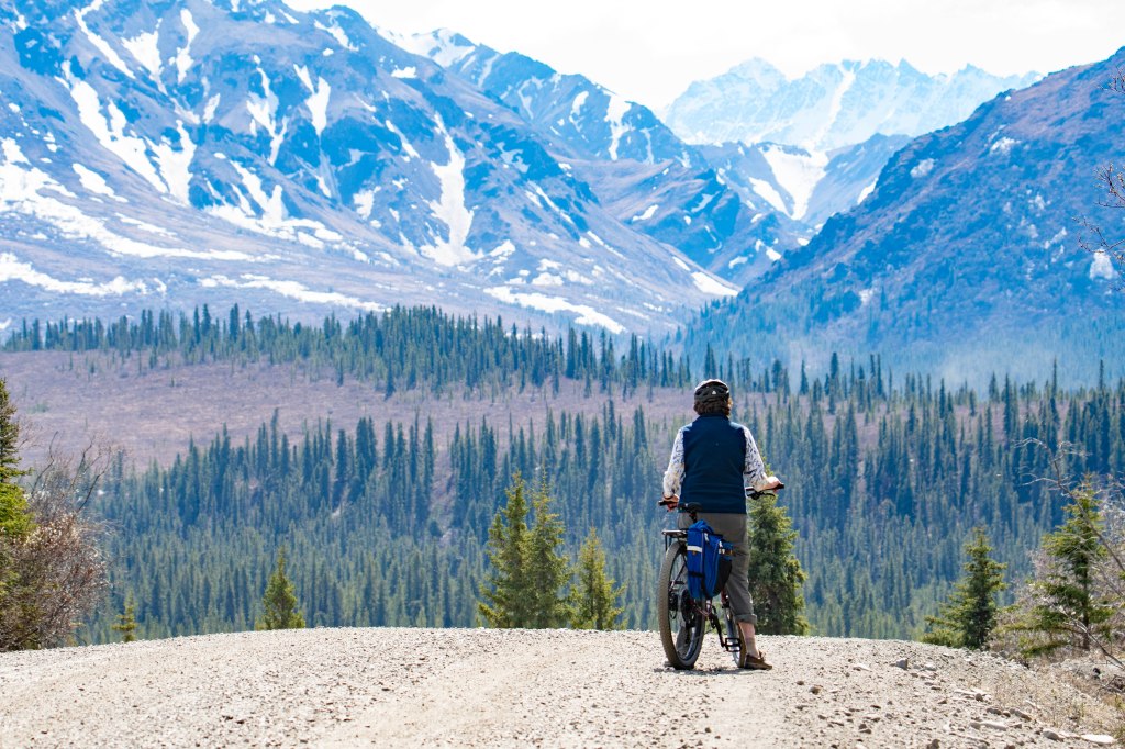
We decided to spend 3 nights at the site leaving us two full days for Haines activities. Morning one consisted of checking out the Fjord Line Ferry schedule and after checking the weather signed up for a wildlife/ferry to Juneau on our second full day in Haines. After exploring a bit of town we drove back out to our campsite and went for a bike ride. There was a terrific headwind starting out, but once we turned around, we were blown back to the campground.
Our campsite is along a lake that flows into the Lynn Canal via a mile long river. The river gets plenty of salmon when they run, but as of now it’s too early for a salmon run. Thus, the bears in the area are feeding elsewhere. I get some camera gear out and head out to photograph an eagle nest along the river. I got a few shots but from considerable distance.
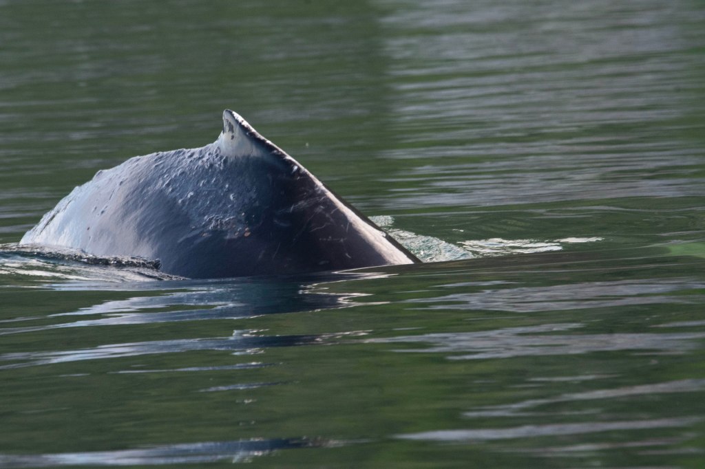
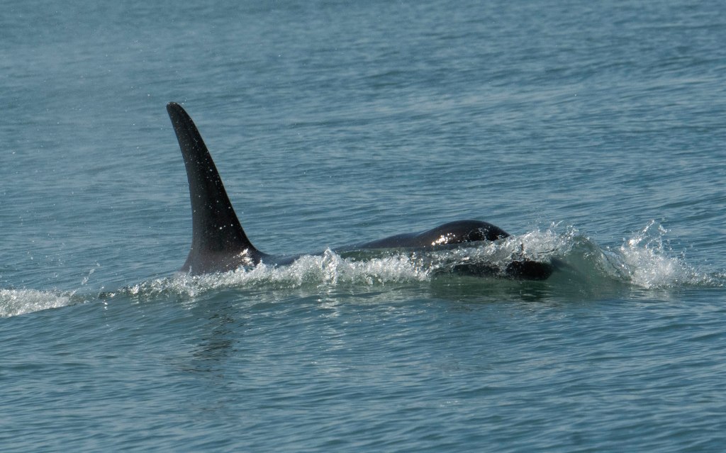
Next morning we got up and out early to catch the passenger ferry to Juneau. Traveling the 90 miles to Juneau takes about 4 hours depending on the amount of wildlife seen. I didn’t get any great photos, but we saw several Humpback Whales, Stellar’s Sea Lions, two Orcas, Harbor Seals, and several Eagles.
Juneau’s an interesting place. It has thirty some thousand people and outside of Anchorage, is one of the largest cities in Alaska. One cannot drive to Juneau. You arrive either by air or water and that’s it. The city center is compact and is within a few blocks of the pier. There are many shops and eateries all thriving on the very high tourist numbers. Currently, Juneau gets up to 23,000 new tourists each day with almost all of them coming by large cruise ship. Often Juneau sees 5 or 6 cruise ships each day. The city is negotiating with the cruise lines to limit visitors from the ships to 17,000 to 18,000 per day with many fewer on Saturdays. It appears this will commence in a couple of years.
Humpback Whale
Orca
We had a great lunch of shrimp and fish tacos then checked out many of the shops. At three thirty we headed back to the ferry and returned to Haines around 8 pm. The next morning, we headed out of town to begin our trip south towards the Pacific Northwest of the US.
Our plans are always flexible. With the trailer issues we had no idea how long we’d be stuck in Whitehorse. With the resolved issue the decision was to push a bit westward then south to Haines. Haines is an Alaskan coastal town with a single road to it that crosses both the Yukon and British Columbia about 150 miles south and west from Whitehorse.
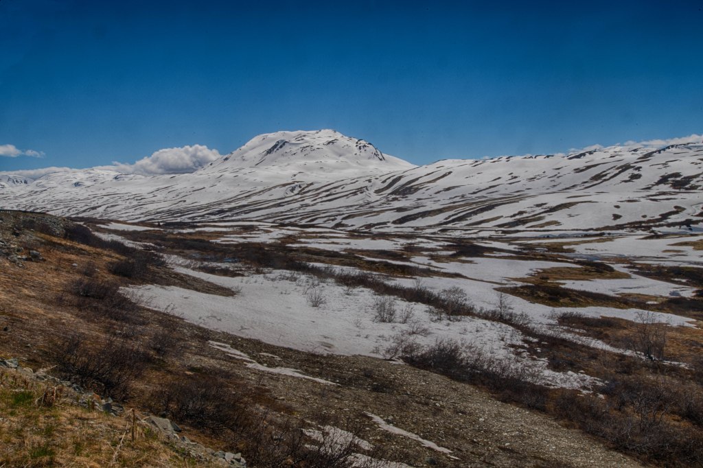
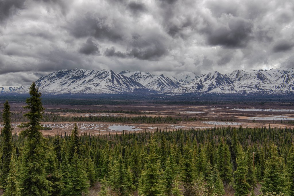
From Whitehorse we followed the Alaska Highway westward back towards Alaska. Arriving in Haines Junction, Yukon we stopped for lunch at a sweet café/bakery on a side street. If you didn’t know about it you would never know it was there. After a great lunch we left the Alaska Highway and headed south on the Haines Highway. It’s 150 miles or so to Haines and the road slowly climbs a couple thousand feet as it passes the mountains. Here the seasons appeared to roll back to winter as we climbed higher into the mountains. The stark, wintery view was amazing.
After the Haines Highway Summit around 4,000 feet the road slowly descends to the US Canadian border. From there it’s a gradual 39 mile trip to Haines. The road passes by the Chilkat Eagle Preserve where thousands of eagles cognate in early November feeding on the Alaska’s latest salmon run. All five Pacific salmon spawn in the Chilcoot River. During Spring and Summer, the river runs high over vast gravel bars and much water seeps into the gravel. In the Fall with less flow coming down the river, the water underneath seeps up into the river and raises the stream temperature. As a result, the salmon run is very late in the season. Eagles are opportunistic and know the fish are easy pickings when there are not many other easy food sources around.
Haines and Skagway sit in the upper reaches of the Lynn Canal. It’s not a canal, rather a fjord. It’s the longest fjord in North America snaking through the mountains roughly one hundred miles from the Ocean. Speaking of Haines and Skagway, they sit 14 water miles apart by water, but about 350 miles apart by road.
There are two rivers near Haines, the Chilcoot and the Chilcat. One is great for viewing eagles in the fall while the other is great for viewing Brown Bears in the summer. We’ve seen and I’ve photographed Brown Bears two other years while we visited in the past.
Other interesting things about Haines. Like other coastal Alaskan towns there’s a free spirit feel mixed with a bit of funkiness and artistic flair. If you are heading north from Washington State on the Alaska State Ferry System, Haines is the end of the line. To go further north on the ferry system one needs to transfer to another ferry route either here or Juneau.
Getting back to the drive into Haines. After the border we were taking our time heading down the highway when a car pulling a loaded small trailer flew past. I didn’t think much about it, but a few miles further down the road the car and trailer were stopped in the road in driving lane. We stopped to see if help was needed. It was needed. The woman was moving from Anchorage to Haines with all her possessions and the trailer bounced off the trailer hitch. It dropped to the road and one of the tow chains broke. The second tow chain stayed intact preventing a potential disaster. In addition, the wiring broke so she did not have any trailer lights including break lights. A young guy around 19 stopped as well. The four of us lifted the trailer back onto the hitch and made sure the one tow chain was still attached.
Once we got her reattached, I suggested we follow her into Haines since we knew all her trailer lights were out. She agreed and thanked us. I also suggested she drive slow since there was still potential for issues. She agrees, got back into her car and zoom she was gone. Every so often we saw her up ahead waiting for us then zoom she was gone again.
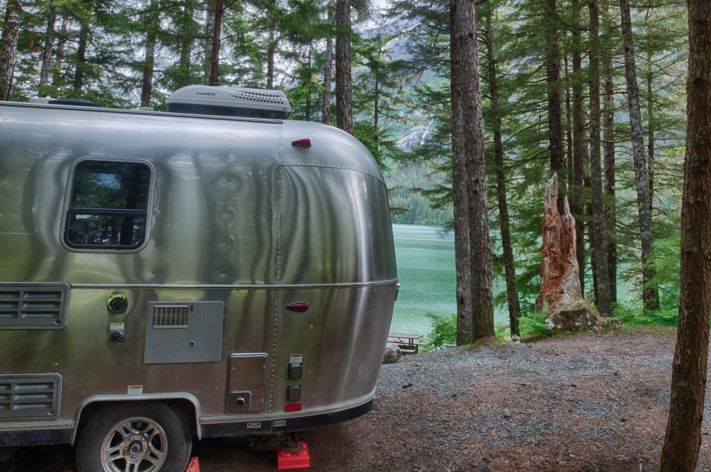
Once we arrived in Haines we did a quick resupply then headed out to the State campground 10 miles from town. We camped here in the past and were hoping to secure another lakeside site. Luck was on our side and we got one. It was next to the site we had for a week last summer.
Lots to get done before we started out on the Dempster Highway. Supplies are very limited on the road north so the first stop was for food supplies. Next stop was to do a trailer dump of wastewater and fill our freshwater tank. Final stop was for gas, propane, and ice. Time to head out of town.
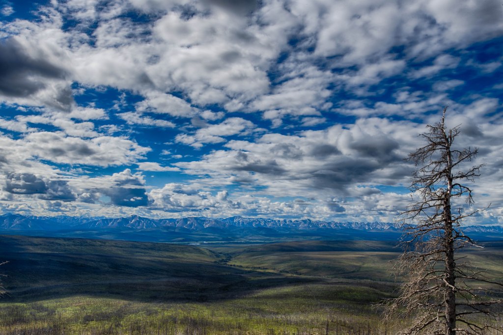
The Dempster Highway starts about 20 miles east of Dawson City. It’s about 400 plus miles to the Arctic Ocean, but we have no idea how far we should go. It depends upon the weather, road conditions, and our mood. My thoughts were as long as the road is passable, we would at least reach Fort McPherson in the North West Territory, of the few places in the US or Canada we have yet to take the trailer into.
It’s roughly a bit more than 400 miles to the Arctic Ocean as the Dempster Highway snakes through mountains, over two rivers with ferry crossings, and plenty of tundra. Fort McPherson is 11 miles beyond the Peel River ferry crossing. In Dawson City we were told at the Visitor Center both ferries were operating. During the warm months the ferries operate while in the winter an ice bridge is built. This is done by pumping river water up onto the ice and letting it freeze. This is done repeatedly until there is a firm surface to drive across. There’s a period of time that neither the ice bridge or ferries can work while the rivers are freezing or breaking up so the road can be used only until 11 miles from Fort McPherson.
So, my thoughts are let’s continue up the Dempster Highway to at least Fort McPherson which is well into the North West Territory getting another sticker for our Airstream door. What is that about? We have large sticker maps for both the US and Canada. When we bring our Airstream into a new state or province we place the place onto our sticker map. To date we taken it to 43 states, all ten Canadian provinces, and the Yukon Territory.
Sow and one of her 2 cubs
Hey Mom, Wait for Me
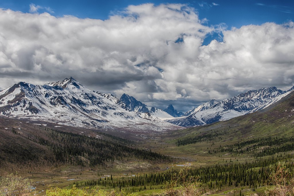
Let me step back for a moment and describe some of the dynamics going on. I want the new territory while Marsha really does not care. I’ve lobbied to head up one of the most remote roads in North America with our trailer. Marsha went along with my wishes, but did express concern especially since we broke the axel last summer on another gravel road, the Denali Highway. That was only 100 miles of unpaved road while the Dempster is over 400 miles long and once one reaches the end it’s 400 miles back to pavement. Heading north the first fuel available fuel is 200 miles up.
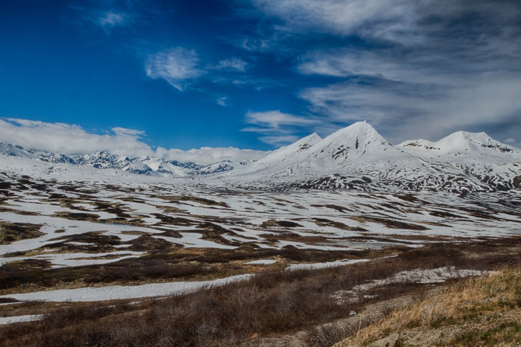
Starting up the highway the views were breathtaking. The road climbs more than 3,000 feet in elevation as the road snakes through several mountains. We stopped midafternoon for the night at a territorial campground. When we pulled in we were the only ones there. By suppertime there were 6 to 8 other campsites used. A cyclist pulled in and we started chatting. Russell lives outside of Vancouver, British Columbia. He is riding from Dawson City to the Tuktoyakuk on the Arctic Ocean and back to Dawson City. In all it’s about 900 miles. We invited him to join us for supper and for coffee in the morning. We very much enjoyed chatting with Russell.
After breakfast we pushed north and the views continued. At the 200 mile point we stop at Eagle Plains to buy some gas at the bargain price of $2.39 per liter. Yes, that works out to about $10/gallon. It’s expensive there, but after converting Canadian to US dollars it was closer to $7.50/gallon. The truck only took $100 worth of gas, but I’ve found it to be prudent to get fuel when you can.
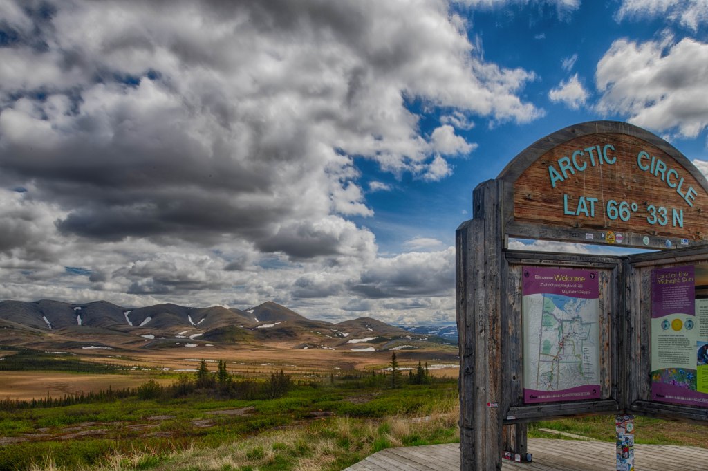
We pushed another 20 miles or so and arrived at the Arctic Circle where we stopped for photos and a picnic lunch. That’s when Marsha noticed the trailer leaning to one side. On closer inspection we discovered we had broken part of our lift kit braces. We have/had a lift kit installed to raise the entire trailer 3’’ further from the ground. It’s a common addition on Airstreams. Not only is the bracket broken but it leaves the axel pretty much unattached on one side. Recipe for a major disaster. I took the wheel off to inspect it more closely and took photos. I was thinking there’s a mechanic 20 miles back in Eagle Plains at the fuel station.
We left the Airstream in the Arctic Circle parking lot and drove back to the gas station. No Mechanic there. The closest mechanic is in Fort McPherson another 100 miles up the road. So, our choice was to contact somebody 100 miles north or 250 miles south. And I thought we had a large towing bill last year!
At Eagle Plains there the gas station and a motel/restaurant/bar which has wifi. A trucker recommended calling a business in Fort McPherson. I should mention it is 3pm on a Friday. I called and spoke with someone who indicated she was waiting for the crew to return and she would have somebody call me back in an hour. Marsha and I have nothing else to do so we hang around. After an hour and a half I called back and spoke with a different person who wanted to see photos of the issue. Fortunately, at Marsha’s suggestion, I had taken some and sent them on to the guy. He said he would get back to me shortly. In sum, he had no interest in helping but did not tell me. Maybe around 7 pm we were heading out the door to camp at the Arctic Circle parking lot and try to figure out what to do tomorrow. As we were going out the door the gas station guy mentioned that the 3 guys on motorcycles that were staying there might be able to help
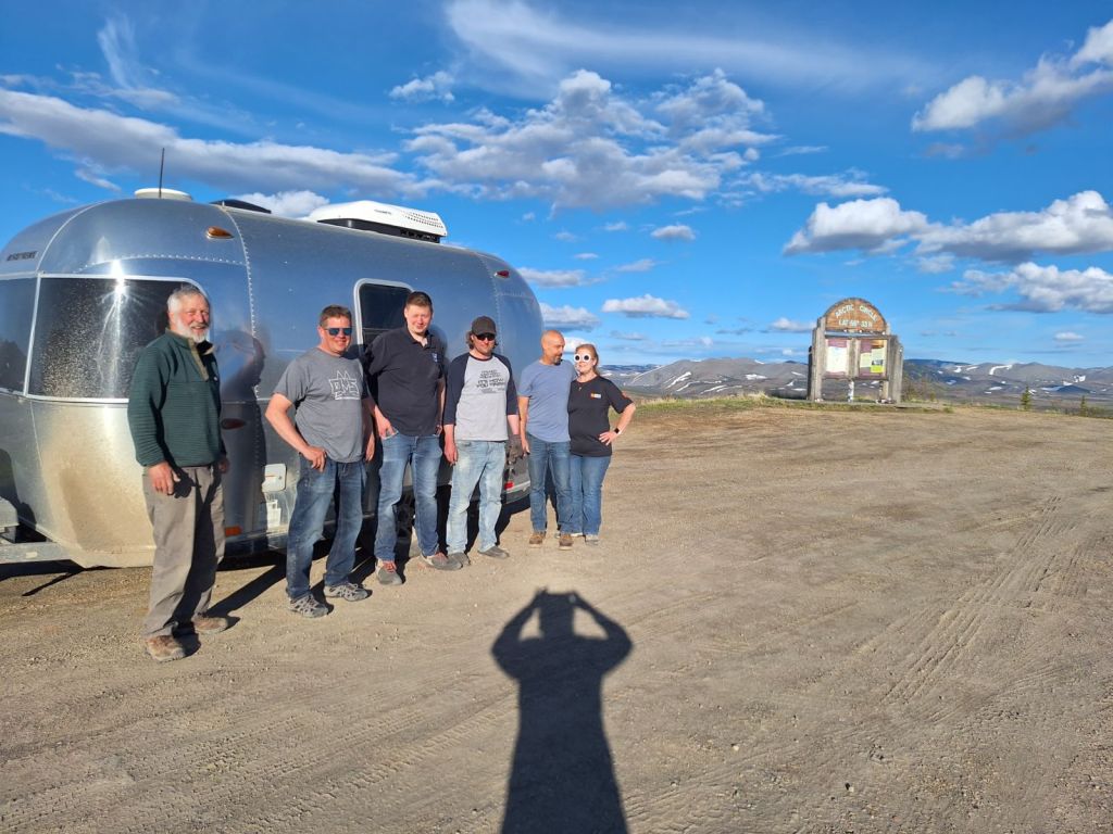
Mark, Hagen, and Joe were on a motorcycle trip from Alberta to the Arctic Ocean then back to home in Alberta. All three were welders and heavy-duty machinists. They were more than willing to help so after moving stuff around in the truck the 5 of use headed to the camper. They even arranged to borrow tools from the gas station. We got back to the trailer, and they got to work. There were not enough tools to do the job, but then a couple pulled into the lot and they had thetools we needed. The are YouTubers and full time RVers. Their YouTube Channel is jarhead Ginger. The temporary fix was to remove the remaining lift kit pieces from the one side and secure the axel. It works, but it’s a temporary fix with our trailer listing to one side. We attach the camper, and we haul it along with us back to Eagle Plains. Then head into the bar where buy them a round of soda. They did not want any money. The next morning, we bought then breakfast as well.
Saturday and Sunday we slowly limped south arriving in Whitehorse, Yukon late Sunday afternoon. Whitehorse is the only place in the Yukon with any size to it and many services. We were hoping we could find somebody who could at least assess what extent of repair we needed. We called a welding place that was recommended, and they saw us at 9 am.
We had several errands to accomplish including laundry. Lunch was at a great Caribbean restaurant. We finished our tasks by 3 pm so me headed to the Yukon Visitor Center and by 3:30 we received the call the trailer was done. They knew how to build the parts and got us fixed! It was amazing. What could have been a $5,000 to $10,000 tow from the Arctic Circle and repair job; was complete and at one tenth the price.
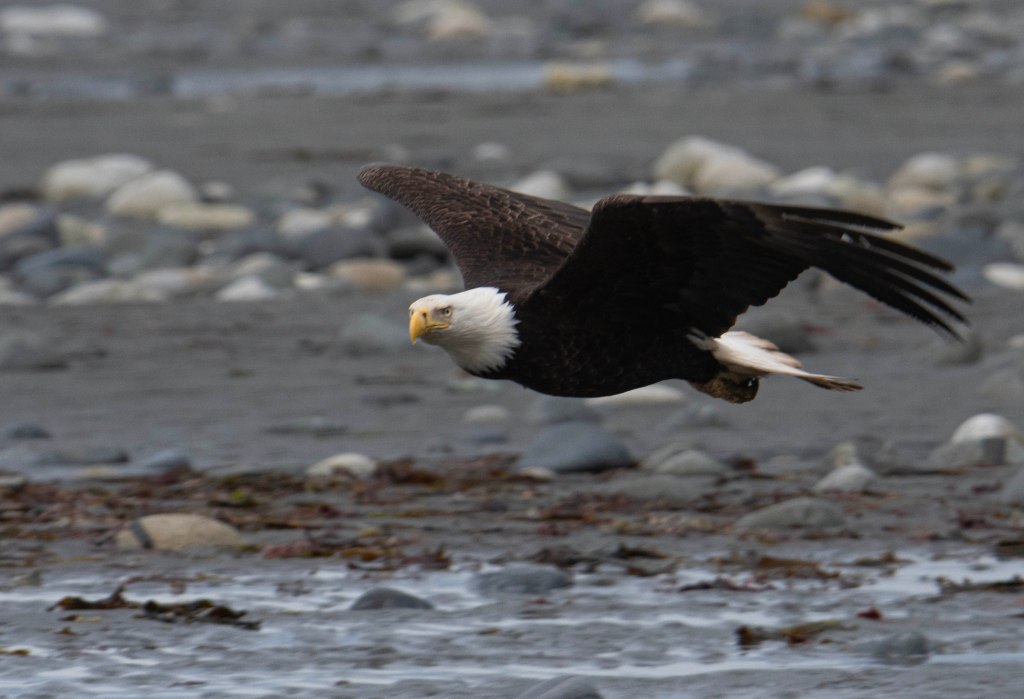
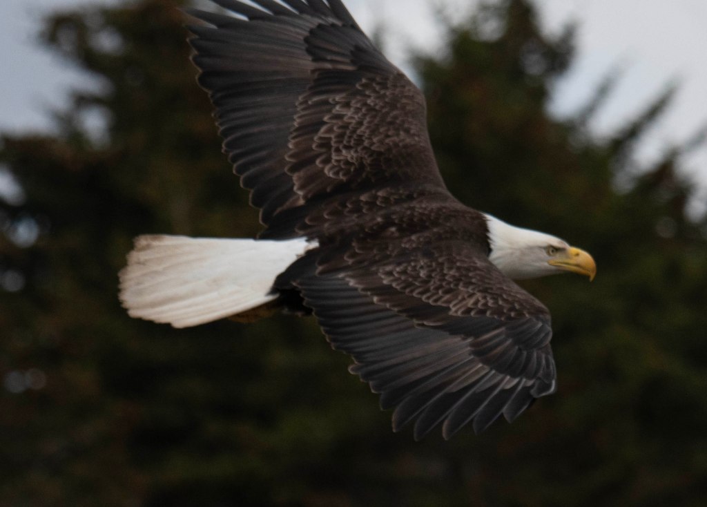
We spent another day around Anchor Point enjoying the many eagles. Here are a few of the photos I took.
The next day we headed north. Our plan was to head towards McCarthy. We were there last year, but we wanted to explore more of this historic area. McCarthy and the Kennicott Copper Mines are interesting in a few regards. Off the beaten path, the town is accessible via a 70 some odd mile gravel road that was built on the original rail road bed built in the early 1900’s to transport copper ore from the mine to the outside world. The mined copper was 70% pure copper. It was built in 1908 and remained open until the high quality ore ran out in the 1930’s. The mine sites and the many buildings are now part of the Wrangell-St. Elias National Park. Those buildings are a few miles from McCarthy. To get to McCarthy, one drives on the gravel road built on the railroad bed. Even today after the road is graded there are tire punchers cause by rail spikes still working up to the surface.
Okay, enough background on McCarthy. We head north from Anchor Point towards Anchorage. There the road turns east, We stopped for the night in a quiet RV park just outside of Palmer. It was a shower and laundry day. Every so often we stay at a commercial campground to take advantage of those services. The next morning we purchase supplies for the next few days since there is little to get in McCarthy except for a few funky places to eat.
From Palmer the road has amazing view. We were on the lookout for sheep in the mountains, but no luck this time. They are often seen in this stretch of highway due to the mineral rich rocks. We stopped at a roadside overview at Glacier View when we ran into 4 National Park Employees. They asked where we were headed and we said McCarthy. They were headed there as well, but are delaying their journey because there was a landside that closed the road. It was expected that it would not open for 4 to 7 days. Oh well, we are not going to McCarthy this year.
We ponder our options then decided not to make any decisions until we got to Glennallen. There was an information center there. It’s also where were needed to turn south towards McCarthy and Valdez or north towards Tok and places beyond. At the information center we were told it was estimated for the McCarthy Road to reopen in 4 or 5 days now. We turned north with a new destination of the Top of the World Highway then on to Dawson City, Yukon.
Fifty miles up the road we stopped at a National Park Visitor Center where they informed us the McCarthy Road was passable following a pilot car. Since we were now headed to Dawson City we decided to not turn around and head to McCarthy.
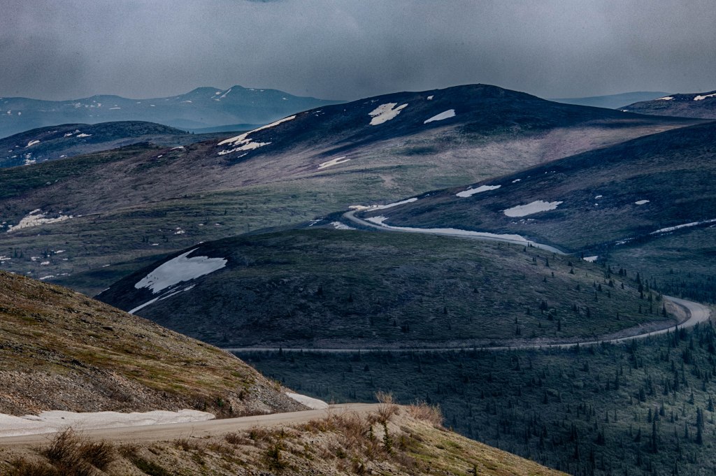
Twenty miles beyond Tok the road to Chicken, AK begins. It’s 80 miles of some of the worst pavement found in North America. In Chicken the road turns to gravel and is maybe a bit better although it is a steep, windy, narrow road. The scenery is amazing. The last 12 miles to the US/Canadian Border is smooth beautiful wide road. Bit like a road to nowhere. We crossed the border to the start of the Top of the World Highway. This highway follows along at or near the top of several small mountains. The road is only open from the end of May or so until sometime in September. At that point the border crossing is closed until the next year. One end of the road is the border and the other is the Yukon River where a free ferry crosses the river to Dawson City. This is the area of the famous Klondike Gold Rush of 1898. Where Jack London wrote Call of the Wild and Robert Service wrote many of his poems. He wrote his poems while living in both Whitehorse and Dawson City. My favorites include The Cremation of Sam McGee, The Shooting of Dan McGrew, The Spell of the Yukon, and the Men that Don’t Fit In. My mother read all of those along with many more to me when I was very young.
We stayed a couple of nights outside of Dawson City and now have plans to at least start the Dempster Highway. It’s the only highway in Canada that crosses the Arctic Circle and it travels all the way to the Arctic Ocean. The only road in the US that does the same is the Dalton Highway heading from near Fairbanks to Deadhorse where the Prudhoe Bay Oil Fields are. We traveled that road in 2018.
This is one of my favorite locations in Alaska. Why? To start with it is the western most point one can drive to on connected roads in North America. That’s just me and my need to do things like that. Over the years we’ve taken our Airstream to the western, eastern, and northern most points one can drive to on connected roads in North America. Well, the eastern most point does include a ferry ride to Newfoundland.
Really, this is not what makes Anchor Point so interesting. A couple of other things make it so. First, Anchor Point is 20 miles from the hub bub of Homer. Homer is a great place for activities and other things, but during the summer Homer Spit is a zoo. During other visits in the past we had difficulties in even finding a parking space. It’s a 5-mile-long spit with most of the shops, RV campgrounds, and harbors located towards the outer most parts of the spit. The campgrounds are crowded with no privacy between sites. Add to that there is plenty of wind.
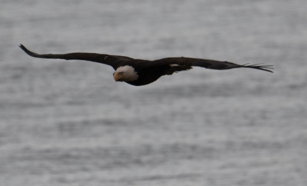
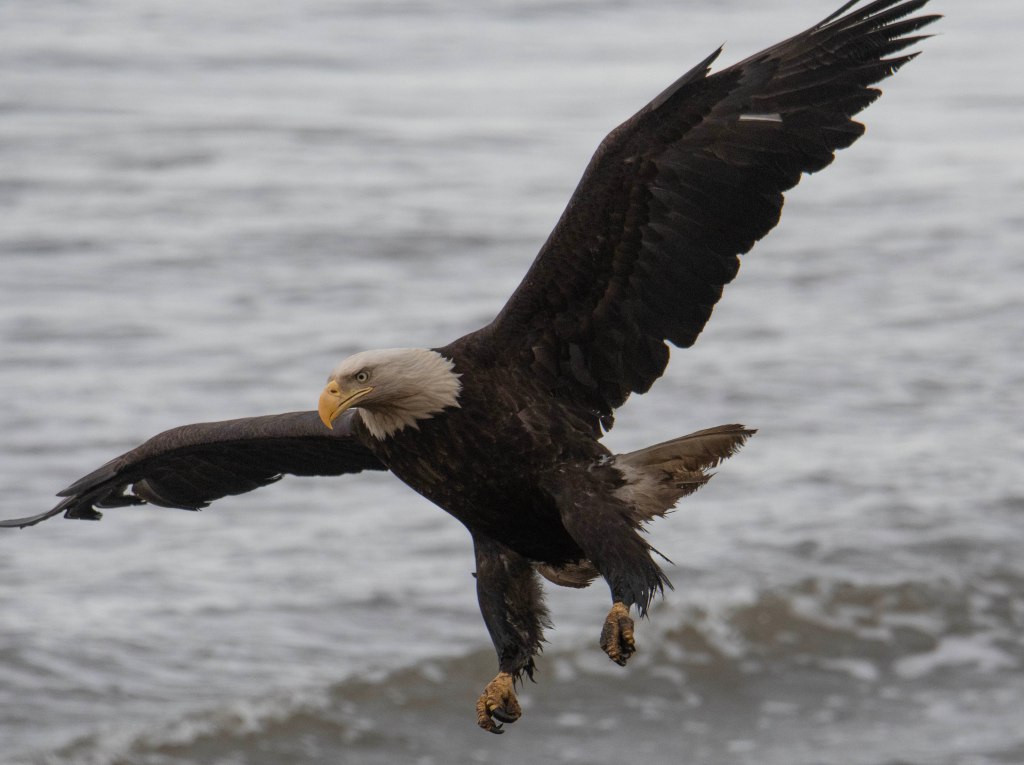
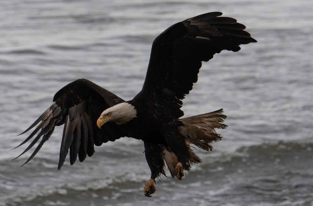
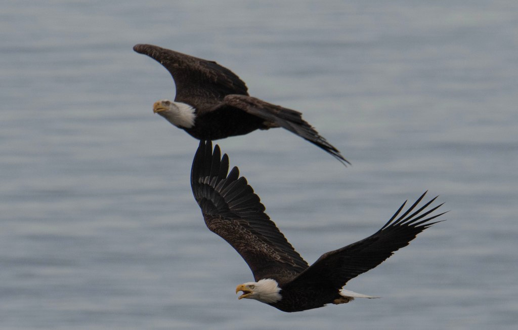
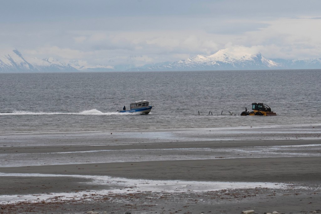
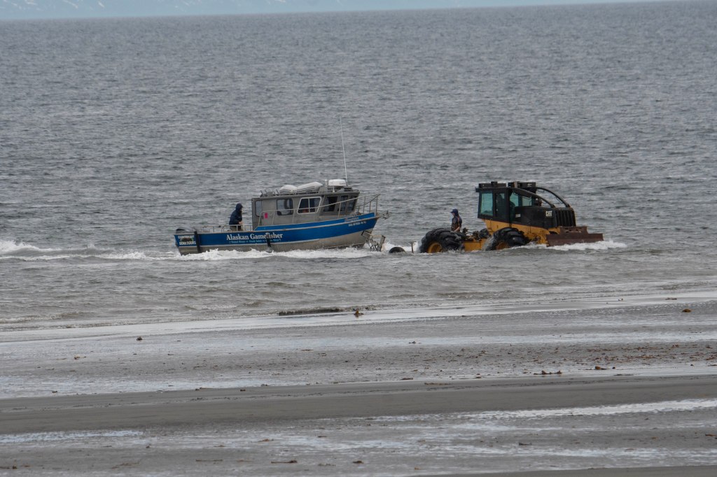
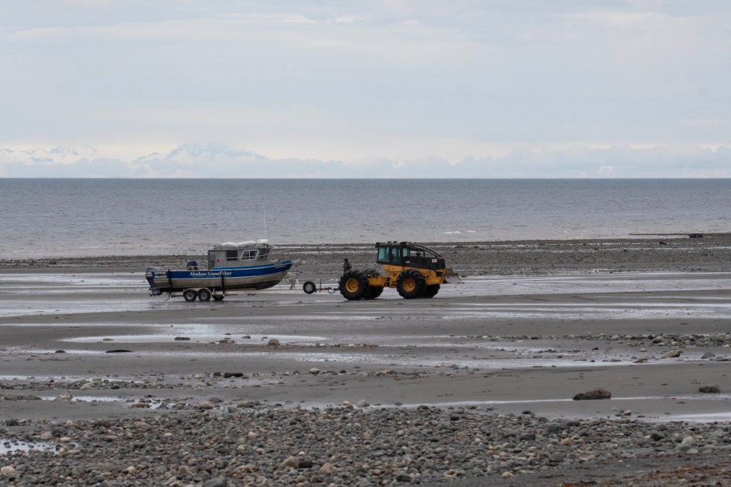
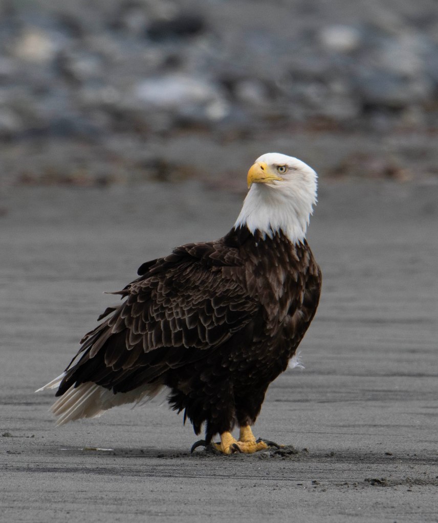
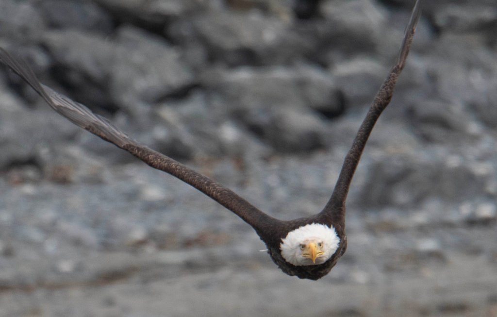
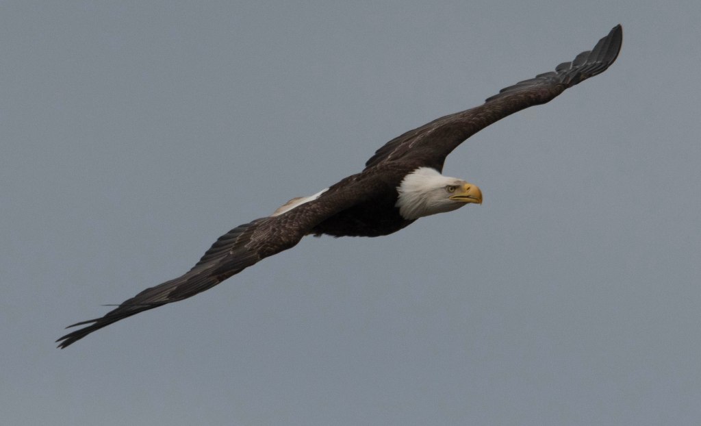
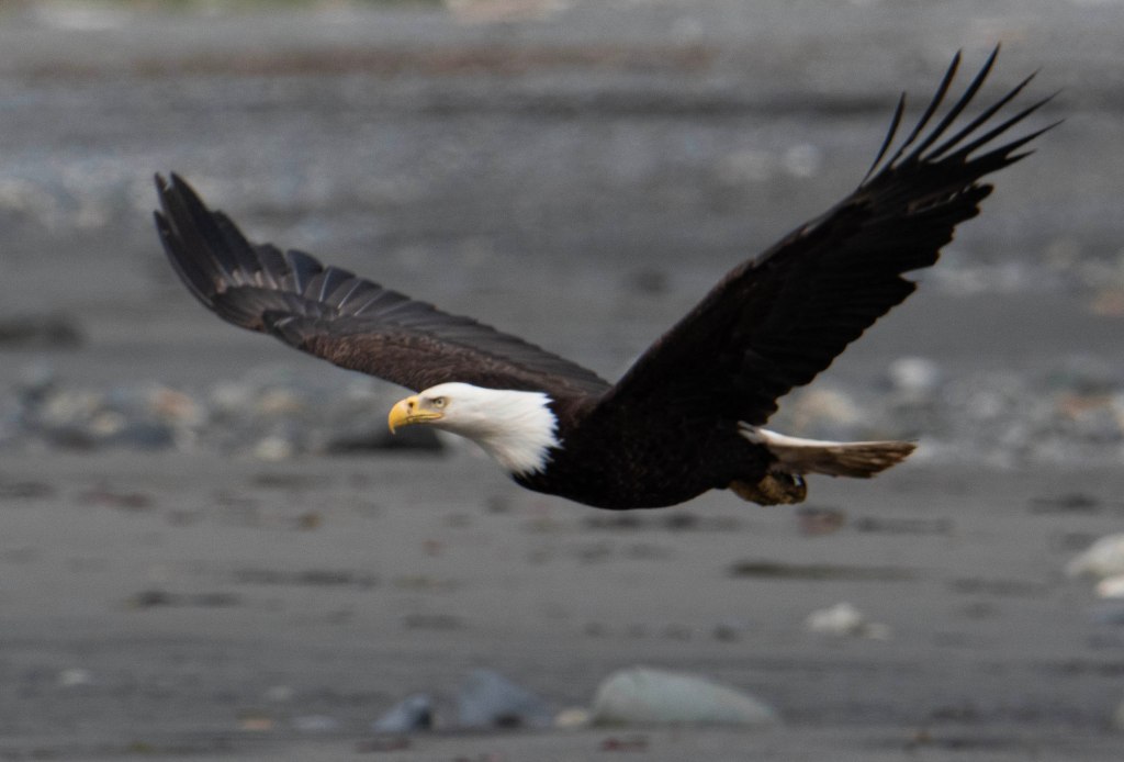
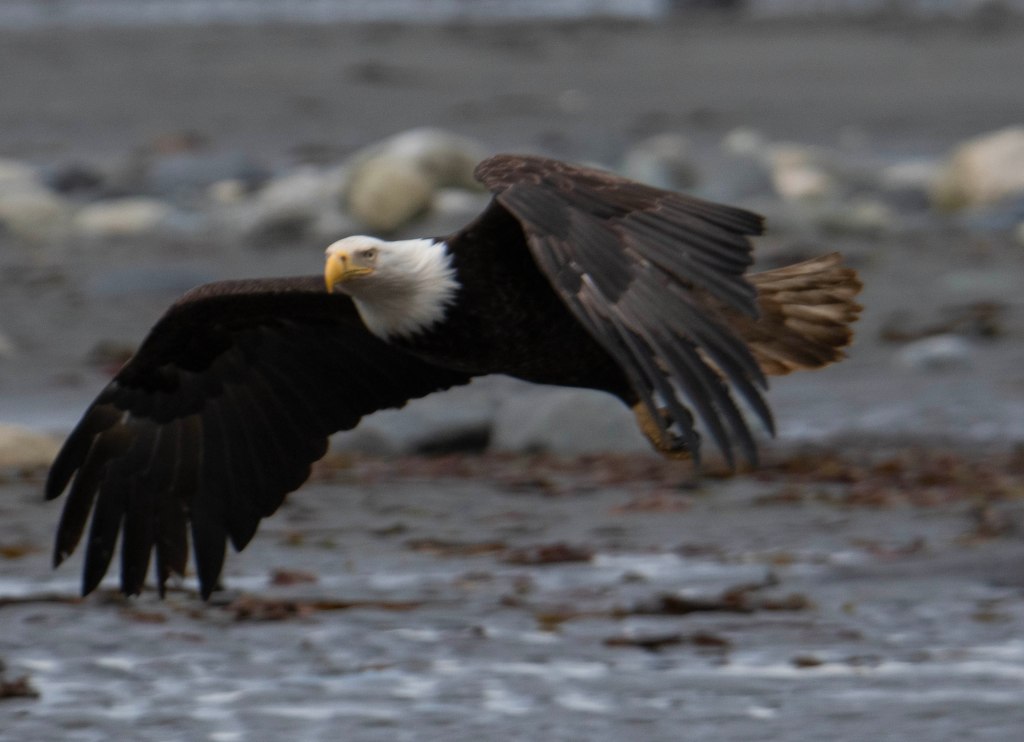
Second, the real gem of Anchor Point for me are the Eagles. The entire area experiences some of the highest tides in world, only second to the Bay of Fundy. At Anchor Point there’s a wide tidal flat of a beach where boats are launched via a tractor towing a trailer into the surf. I’ll include a couple of photos of the launching/docking process here.
The boats here are sport fishing boats. When they land, they clean their catch and throw the fish waste onto the beach well below the high tide line. This makes for the perfect bird feeder for Ravens, Crows, and Eagles. It’s not very exciting or photogenic while the eagles are eating the fish waste, but it is a great opportunity to capture photos of eagles in flight or landing. Here are a few examples.
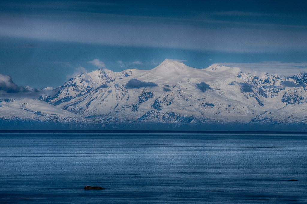
We been offline most of the past week. Here’s a brief overview of our past week. We left Denali National Park heading south towards Anchorage with plans to stay in Eagle River State Recreation Area 10 miles before Anchorage. We stayed there several days last summer while visiting friends in Anchorage. It was Thursday before Memorial Day. We thought the Memorial Day Weekend could be busy. We planned to hunker down for the weekend then proceed south to the Homer area. When we arrived we discovered the campground was full so we continued south of Anchorage. We stopped at a state rec campground near Girdwood for the night. Our next destination was Captain Cook State Rec campground along the water 38 miles north of Kenai. Along the road to the campground we expected nothing but woods. To our surprise we passed a couple of oil refineries and a fertilizer Plant. Beyond there it got a bit more rural. The campground is at the end of the road and there were plenty of campers, but it was not at all full. The mountain views across the inlet were amazing and very clear. Rumor had it that several of the mountains were volcanoes.
We stayed there for 3 nights waiting out the holiday weekend. After our stay there we continued towards Anchor Point, 20 miles north of Homer. Our first night we stayed in a private campground so that we could dump our sewage tank, fill up with fresh water, shower, and do laundry. It also was time to do a couple of maintenance items on the camper. The heater stopped working again, but this time I was prepared and had a 5 amp fuse. Replaced the fuse and it’s working again.
This is where things got interesting. We were both in the trailer and as we got ready to head to the truck, the door latch does not work. We are stuck inside the camper. I got out by exiting the rear window which is the emergency exit. It was not easy, but I finally got out. I would never want to get out fast in a real emergency, but I got out. The latch worked from the outside so I could let Marsha out.
Okay, it was time to work on the latch. I took it apart then put it back together thinking that I fixed it. Time to test it so we are on the outside of the trailer and I close the door only to discover the deadbolt lever was activated. Once we closed the door it was locked. So now we were unable to get in the trailer! Fortunately, there is access into the trailer from the rear storage compartment located under our bed. It was a tight fit, but Marsha managed to wiggle her way in. Once inside she could undo the deadbolt then I could open the door from the outside.
After a couple of hours working the problem I gave up and called a locksmith located in Homer. We towed the trailer into Homer and the locksmith had it working after 20 minutes. Lesson learned.
It’s a bit colder 30 miles into the Park. We are awake a couple of hours after sunrise, but sunrise is before 4am. Our plans are to ride the bus along the Park road with the hopes of spotting wildlife. The transit buses come along every 30 to 60 miles. We catch one heading towards the Park entrance. We ride to Savage River where cars are not allowed to venture deeper into the Park. The buses continue beyond the Savage River stop, but if we go any further then we need to purchase new bus tickets. Our tickets, $33.25 each, are good for our entire stay while we stay beyond Savage River at Mile 14 to the turn around point around Mile 42. The road remains closed beyond that point due to the construction where the major landslide happened. I heard the repair will be completed in 2025-2027 timeframe. If you are headed to Denali NP check their website on road construction updates.
The transit buses are not narratives on what one sees, but most of the drivers will stop if you shout out STOP and all on the bus including the driver will look for or at the wildlife. They don’t need to stop, but normally they do. Plus, they will talk about the wildlife habits. Our first bus ride did not have someone that really wanted to let the riders know much of anything. If somebody yelled STOP she stopped the bus for a few seconds then continued on. At Savage River we boarded a bus back towards where we had just traveled. The bus driver encouraged us to look for wildlife and he stopped for just about anything. We saw several bear shaped rocks and vegetation that resembled a moose, but no successful sightings. We did see Cariboo and Dall Sheep. At the bus turn around point we continued back to our Campsite. We caught our first bus at 10 and hopped off around 2.
Back at our camper we had lunch and hung around for a bit. They we invited a couple camping near us to join us for a bit. It was a delightful conversation.
May 22
Another cold morning with an inside temperature of 46. We could warm up the camper overnight, but it’s so cozy with the cold air while being under warm blankets. Before coffee making time I turn on the heater and wait another 15 minutes before getting out of bed to make coffee.
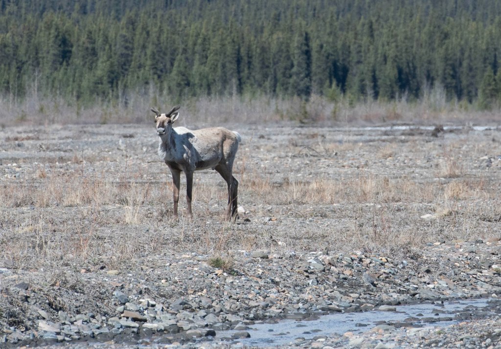
By 8:30 we were out waiting for the bus to take us to the end of the open road. We spied Dall Sheep, one with a newborn kid, and plenty of Cariboo. The lighting was beautiful. The bus dropped us back at our campground just before noon so next was lunch. Afterwards we walked out on the gravel bars along the Teklanika River. Soon we spotted 4 Cariboo. Although I did not have a long lens they were close enough to capture some decent photos.
With our late afternoon ritual playing Cribbage we were outside at the picnic table when a Spruce Grouse flew into the tree 20 feet away. I had my camera with me and captured a nice shot.
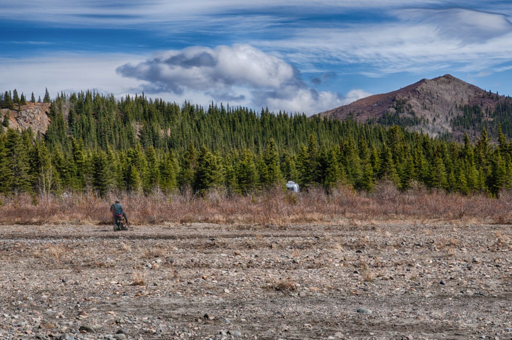
River Bed next to our camp site
A view from the river bed looking at our camp site with Marsha heading back to the trailer
Cariboo wondering who is using my territory
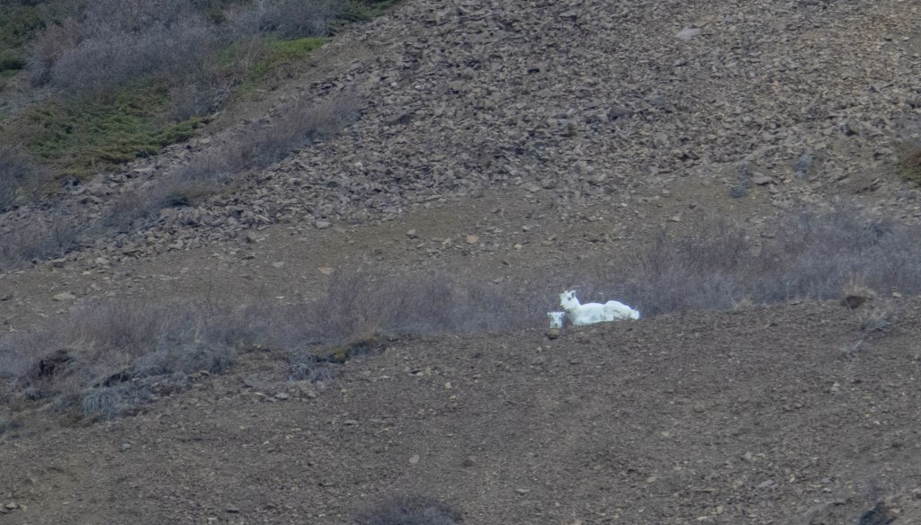
Dall Sheep with lamb
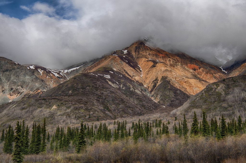
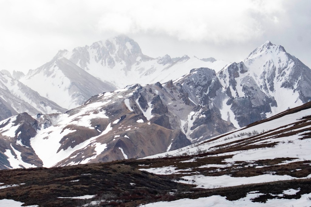
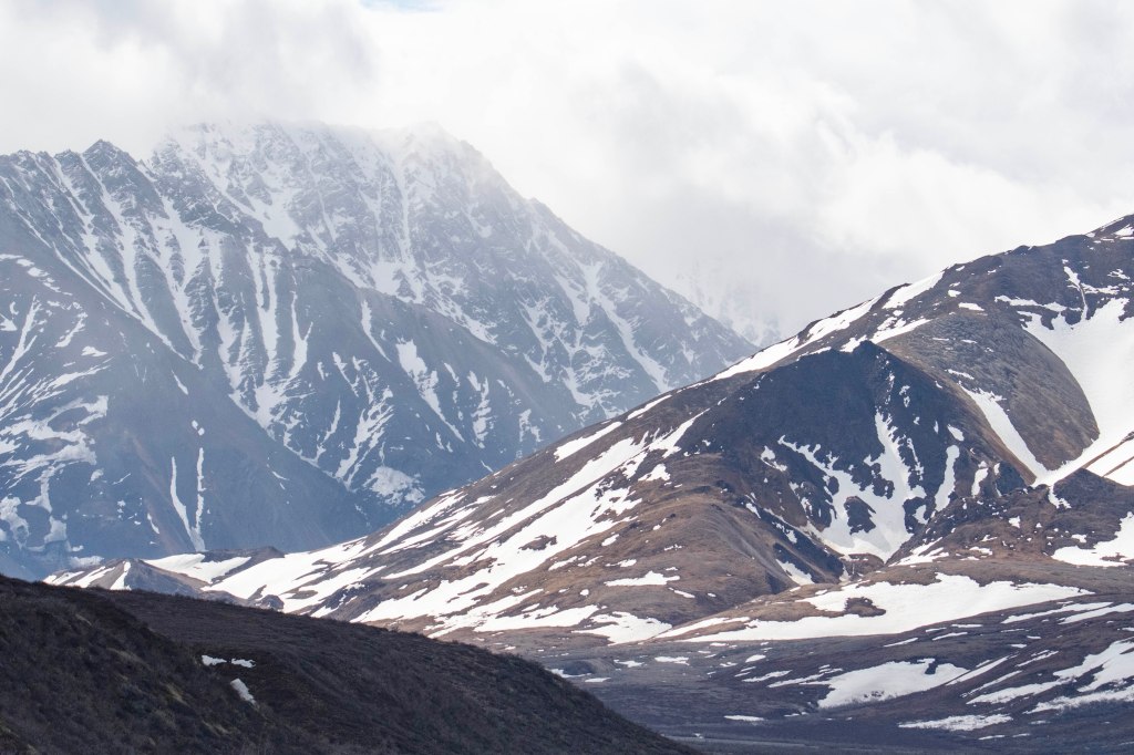
Rugged Landscape
More Rugged Landscapes
Spruce Grouse – While playing Cribbage at the picnic table at our camp site this guy flew into a tree 20′ away. I took this while sitting at the table.
Teklanika Campground at Mile 39.5 on the Park Road, opens on May 20. We’ve transitioned to the opening of the “summer season” in Denali National Park. Prior to today one could drive all the way to mile 30. In the summer you can drive a private vehicle only to mile 14 at Savage River. May 20 is also the day a few of the interior campgrounds open. If one has a reservation at an interior campground one can drive to that campground. However, once parked the vehicle must remain at the campground until the end of your stay. If you use your vehicle then you must leave. In the morning, we prepare to head to our new spot. At Mile 14 the road becomes gravel. The speed limit remains at 35, but that kicks up a huge dust cloud. We putz along at 15 to 19 mph to keep the dust down. At this speed it’s easier to spot wildlife, but as we discovered over the past few days wildlife viewing is best at low speeds. Furthermore, wildlife spotting is the luck of the draw. One time we see lots of wildlife while an hour later there’s nothing. Our trip to Teklanika Campground only revealed a few Cariboo along with several ptarmigan.
Arriving at the campground we secure a beautiful spot within sight of the Teklanika River. As the day goes on more campers arrive, yet there are several spots unoccupied. Basically, all the non-river view sites.
Camp is set up we pull out the bike and enjoy a short bike ride.