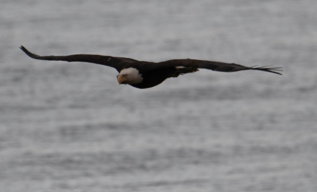
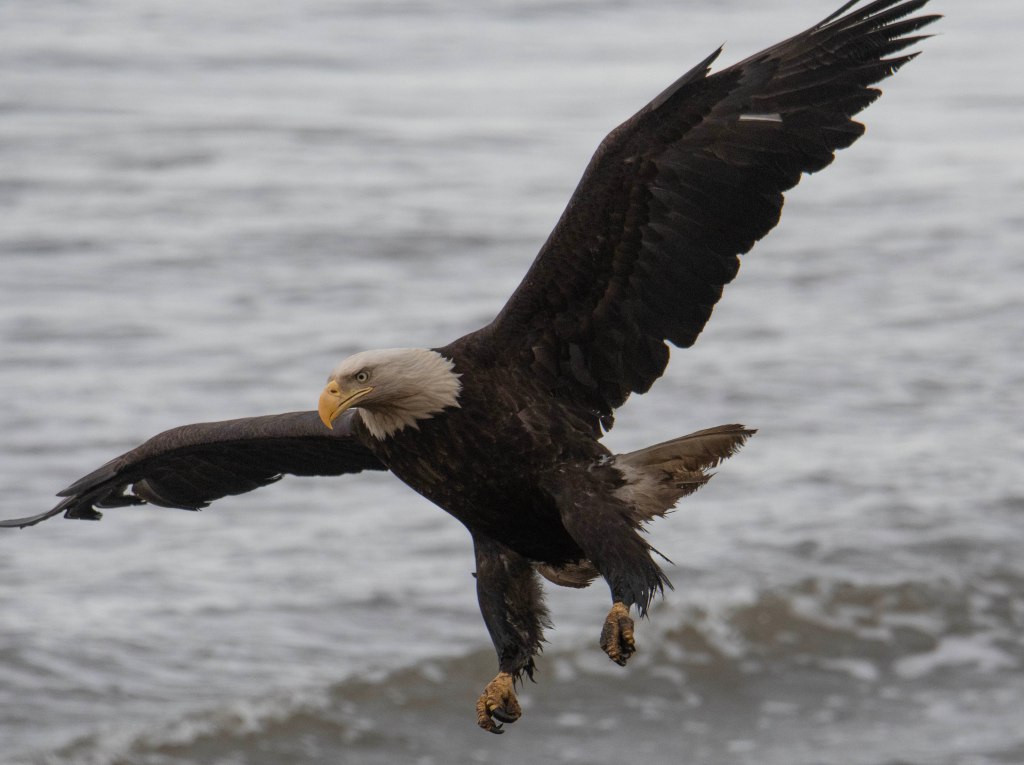
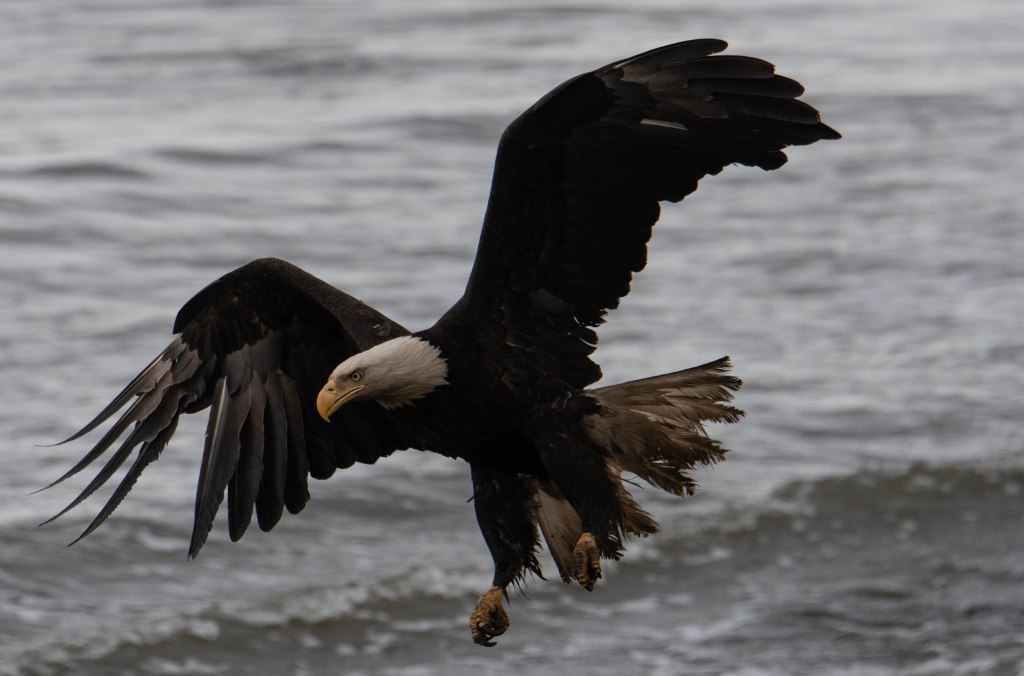
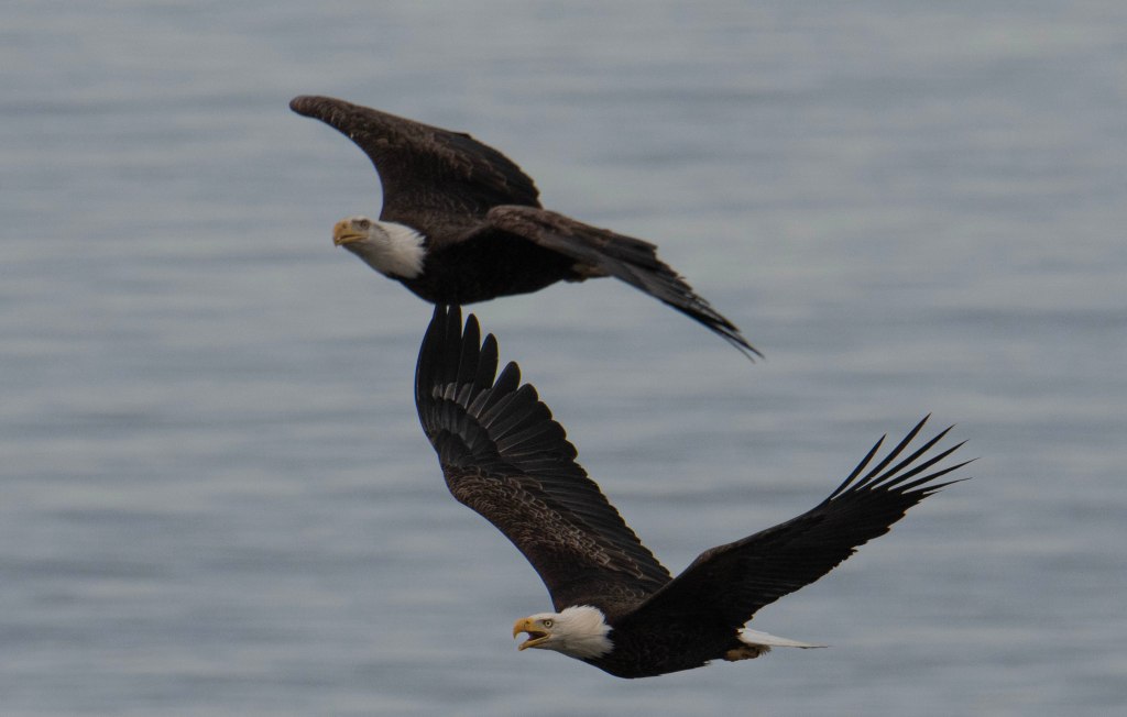
We spent another day around Anchor Point enjoying the many eagles. Here are a few of the photos I took.


The next day we headed north. Our plan was to head towards McCarthy. We were there last year, but we wanted to explore more of this historic area. McCarthy and the Kennicott Copper Mines are interesting in a few regards. Off the beaten path, the town is accessible via a 70 some odd mile gravel road that was built on the original rail road bed built in the early 1900’s to transport copper ore from the mine to the outside world. The mined copper was 70% pure copper. It was built in 1908 and remained open until the high quality ore ran out in the 1930’s. The mine sites and the many buildings are now part of the Wrangell-St. Elias National Park. Those buildings are a few miles from McCarthy. To get to McCarthy, one drives on the gravel road built on the railroad bed. Even today after the road is graded there are tire punchers cause by rail spikes still working up to the surface.
Okay, enough background on McCarthy. We head north from Anchor Point towards Anchorage. There the road turns east, We stopped for the night in a quiet RV park just outside of Palmer. It was a shower and laundry day. Every so often we stay at a commercial campground to take advantage of those services. The next morning we purchase supplies for the next few days since there is little to get in McCarthy except for a few funky places to eat.
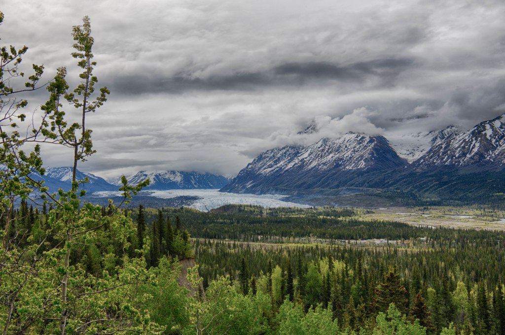
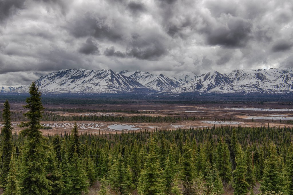
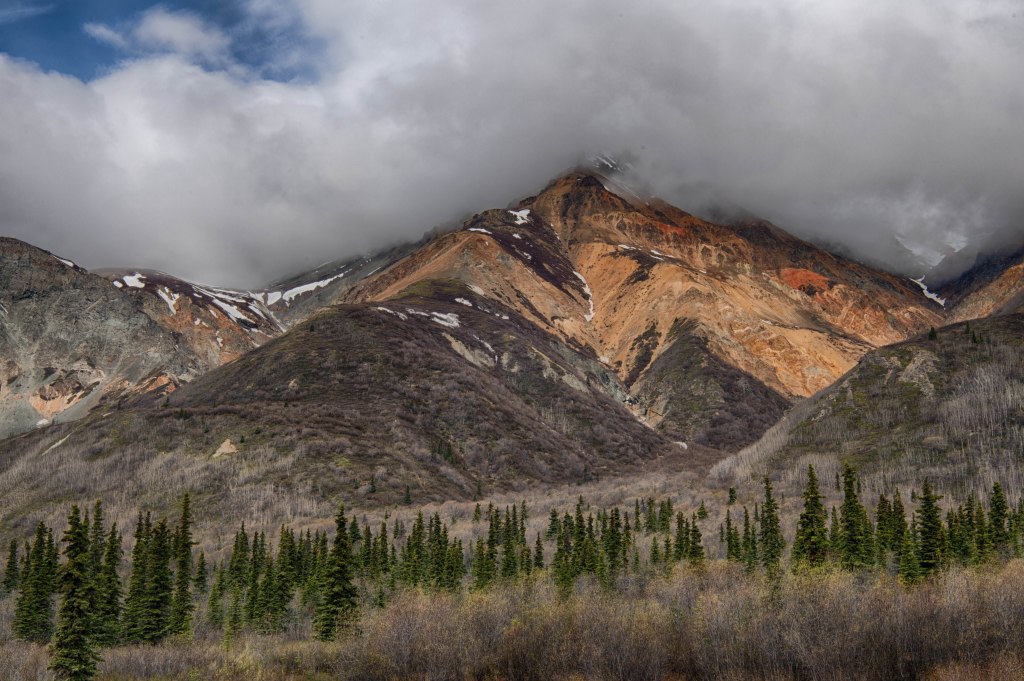
From Palmer the road has amazing view. We were on the lookout for sheep in the mountains, but no luck this time. They are often seen in this stretch of highway due to the mineral rich rocks. We stopped at a roadside overview at Glacier View when we ran into 4 National Park Employees. They asked where we were headed and we said McCarthy. They were headed there as well, but are delaying their journey because there was a landside that closed the road. It was expected that it would not open for 4 to 7 days. Oh well, we are not going to McCarthy this year.
We ponder our options then decided not to make any decisions until we got to Glennallen. There was an information center there. It’s also where were needed to turn south towards McCarthy and Valdez or north towards Tok and places beyond. At the information center we were told it was estimated for the McCarthy Road to reopen in 4 or 5 days now. We turned north with a new destination of the Top of the World Highway then on to Dawson City, Yukon.
Fifty miles up the road we stopped at a National Park Visitor Center where they informed us the McCarthy Road was passable following a pilot car. Since we were now headed to Dawson City we decided to not turn around and head to McCarthy.
Twenty miles beyond Tok the road to Chicken, AK begins. It’s 80 miles of some of the worst pavement found in North America. In Chicken the road turns to gravel and is maybe a bit better although it is a steep, windy, narrow road. The scenery is amazing. The last 12 miles to the US/Canadian Border is smooth beautiful wide road. Bit like a road to nowhere. We crossed the border to the start of the Top of the World Highway. This highway follows along at or near the top of several small mountains. The road is only open from the end of May or so until sometime in September. At that point the border crossing is closed until the next year. One end of the road is the border and the other is the Yukon River where a free ferry crosses the river to Dawson City. This is the area of the famous Klondike Gold Rush of 1898. Where Jack London wrote Call of the Wild and Robert Service wrote many of his poems. He wrote his poems while living in both Whitehorse and Dawson City. My favorites include The Cremation of Sam McGee, The Shooting of Dan McGrew, The Spell of the Yukon, and the Men that Don’t Fit In. My mother read all of those along with many more to me when I was very young.
We stayed a couple of nights outside of Dawson City and now have plans to at least start the Dempster Highway. It’s the only highway in Canada that crosses the Arctic Circle and it travels all the way to the Arctic Ocean. The only road in the US that does the same is the Dalton Highway heading from near Fairbanks to Deadhorse where the Prudhoe Bay Oil Fields are. We traveled that road in 2018.
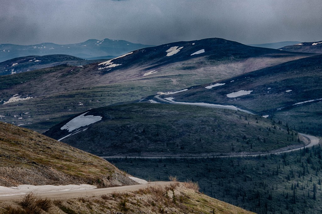
Top of the World Highway
