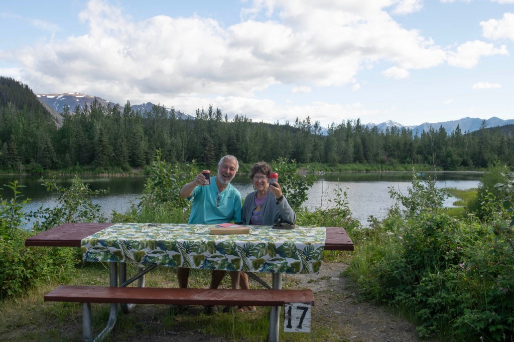
Before talking about July 15 let’s spend some time with the 14th. It’s Friday the day of our reservations for the Lu Lu Belle Wildlife Glacier cruise. We done the cruise back in 2018, Marsha once and Wells twice. With the cloudy, cold and drizzly days all week we did not know what to expect weather wise. We wake to drizzle and temperatures hovering around 50. Not looking like a good day to be out on the water. Between the drizzle and fog visibility is not stellar.
Captain Fred started doing these cruises in 1978 and continues to this day. He’s in his mid-eighties and very healthy. He moves around the boat and boat ladders with ease. A few other things about him is the cruise leaves the dock at 10:30 am and returns at some point late in the day. It really depends on what is available to see. Once the Lu Lu Belle pulls away from the dock he is at the helm with a microphone which he uses almost continuously until the cruise is over. He talks about the history of Valdez and the surrounding areas, the Exxon Valdez oil spill, the safety measures put in place since the spill, the 9.2 1964 Good Friday Earthquake, the Columbia Glacier (named after Columbia University), the salmon, the salmon fishery, the wildlife and sea life, and more. He brings in a bit of politics which is from the Alaskan viewpoint with a very negative view of the Federal Government. He weaves many stories but at some point we tune him out.
The day after the cruise we head north along the Richardson Highway towards Paxson and the start of the Denali Highway. We make it to just a few miles before the beginning of tomorrow’s adventure. Weather is rainy and foggy. We hope it clears for tomorrow.
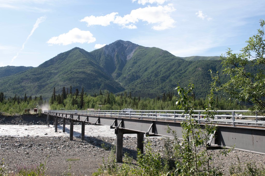
Last night we camped at Paxson Lake BLM Campground. We woke with high expectations to experience the Denali Highway. At one point the Denali Highway was the only way via vehicle to get to Denali National Park, but at some point, it was mostly forgotten when the Parks Highway from Anchorage to Fairbanks was completed. The Denali Highway is an East West two lane mostly gravel and stone and oil road that wanders through remote territory roughly 130 miles long.
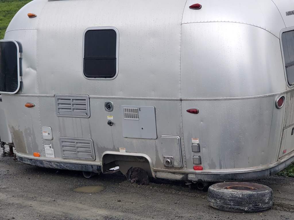
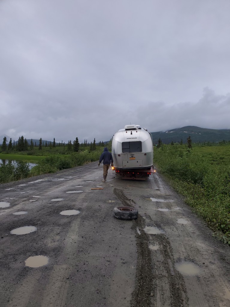
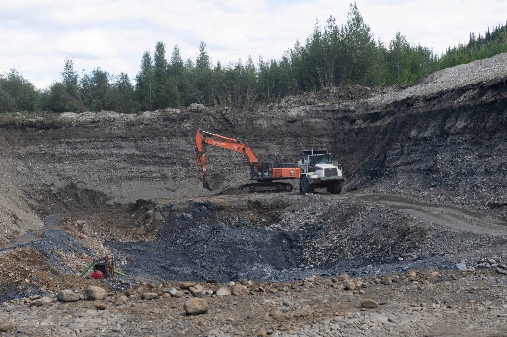
We expected to complete the drive in one or two days enjoying the views (mostly rain and fog). Once we hit the Parks Highway we’d continue north to Fairbanks. About 80 miles from the eastern starting point and about 50 miles from the end point we lost an entire whee.l. It dropped off with the axel dragging on the ground. We were extremely fortunate that we were going through some potholes and moving at 5 to 10 mph. Nobody was hurt plus we were only 2 miles from a Roadhouse which consisted of a bar, gas, and a closed lodge. Seven of the first ten cars/trucks to pass by stopped and offered to help. I accepted a ride to the Roadhouse where the key resource they have is Internet!
As I was waiting to contact a tow truck one of the owners went and picked up Marsha leaving the truck and camper on the roadside. As I write this it’s 6:30 pm and we are now both back at the truck and trailer waiting for the tow truck to arrive from Cantwell, fifty miles away. He expects to arrive between 7 and 7:30. We will be towed to an RV Campground in Cantwell then we’ll need to determine if there is a place to repair the axel. We expect to be without our travel trailer for an extended period. I’ll write more once we have a better idea.
The tow truck arrived at 7:04 and we were off loaded and in a campground in Cantwell. We jacked up the one side of the Airstream so we are somewhat level. Tonight we rest and tomorrow we start calling around to repair places north or south of us. Fairbanks is 150 north and Wasilla is 165 south. Hopefully, parts and the availability of someone to work on the trailer will happen. We’ll see.
In the meantime, we are in good spirits and look at this as just another part of our adventure.
Yesterday’s efforts in resolving the battery issue is a success. The charge controller now sees our batteries as lithium and charges them correctly. It was a great learning opportunity and easily fixed once we determined what was wrong. If it happens again, it should be an easy fix.
It’s another cool and cloudy here in Valdez. Todays a shower day and we both are fresh and clean. Heck we are even wearing clean clothes!
We explore the area for bears with no luck. Later Marsha went for a walk around the town while I went out looking for something to photograph. I’ll let the photographs show you want I saw.
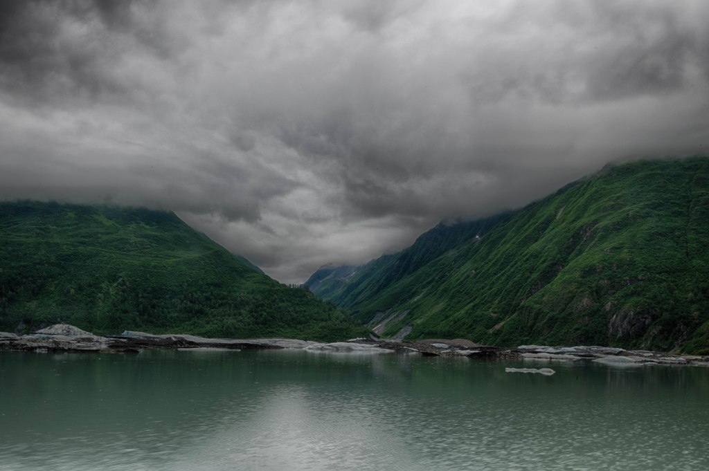
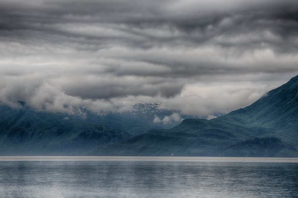
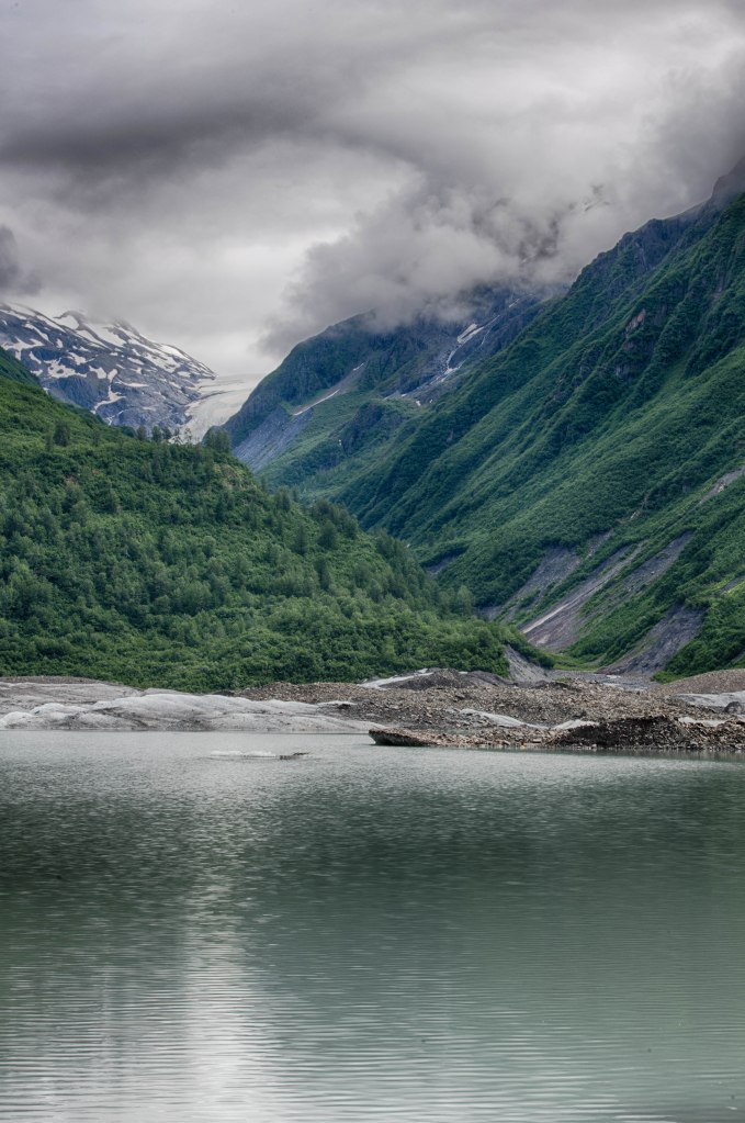
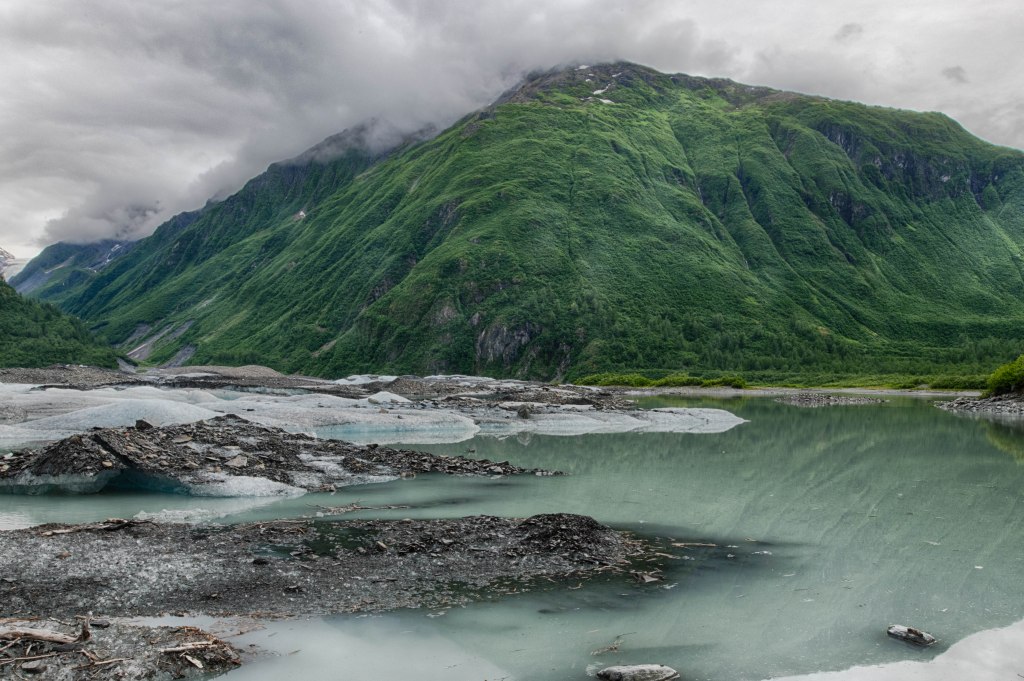
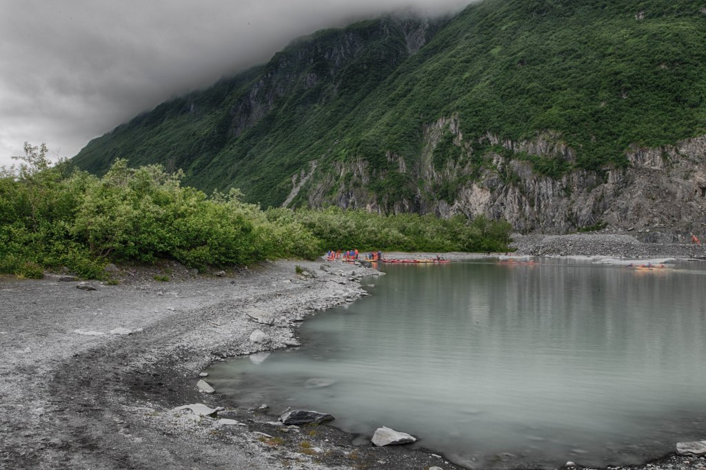
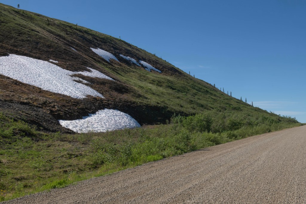
Valdez Glacier Lake – We’ve had clouds with temperatures in the 50s and 60s all week.
Valdez Glacier Lake
The inlet near Valdez
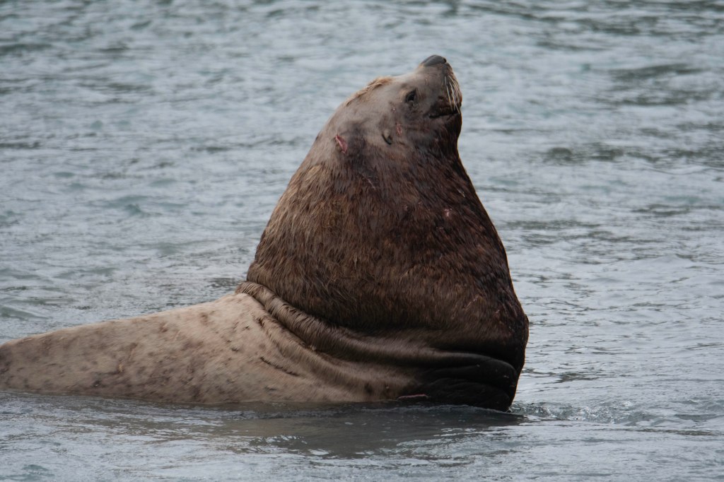
Sea Lion
Sea Lion and Gull
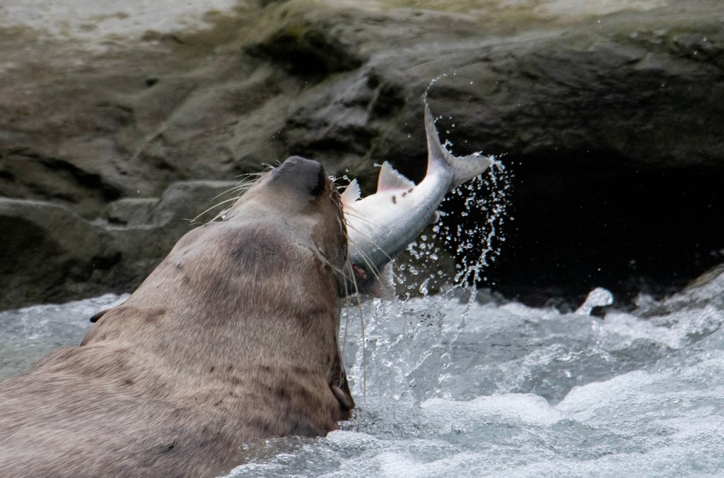
Sea Lion Gulping down a fish. It was down the hatch with 3 seconds
Seems like every other day there is something to troubleshoot. This past winter we upgraded to lithium batteries in our trailer allowing us to be less dependent on either being plugged in to shore power or a generator. The batteries supply most of our power needs. The new charge controller has not been keeping the batteries fully charged so it was time to dive in and figure out what is going on. Here in Valdez, we have good internet plus we are plugged in to shore power at the campground so it’s a good place to work on the problem. Thanks to various RV discussion forums and YouTube the device that charges our batteries, the charge controller, auto detects if it is charging lead acid batteries or lithium batteries. It now thinks we have lead acid batteries so it’s not properly charging our batteries. The charging mode can be reset by draining the battery way down then complete a full charge cycle. This morning we unplugged from shore power then turned on the two DC fans and all the DC lights in the trailer. About seven hours later with the batteries down to 30% we plugged back into shore power. At least for now it seems to have corrected our problem, but we will not know for sure until tomorrow morning after the fully charge cycle is complete.
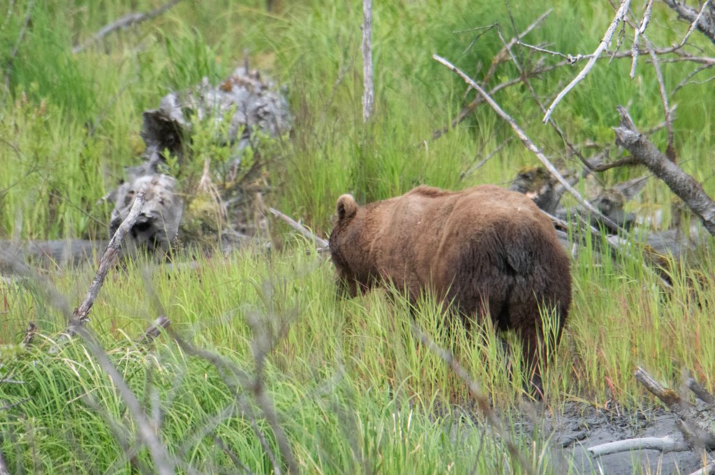
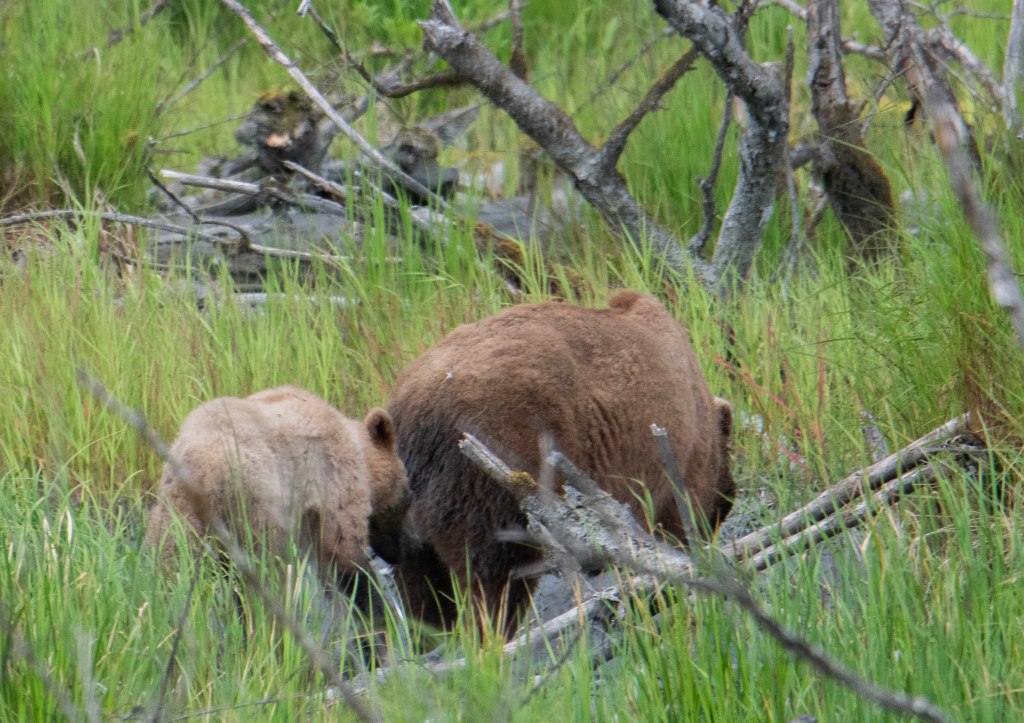
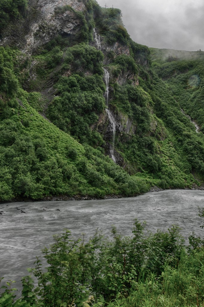
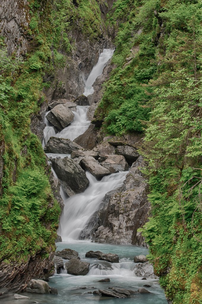
With both fans running on high the noise level was a bit much. Marsha did laundry and walked around town while I headed out to Keystone Canyon to photograph a few of the stunning waterfalls there. After that while heading back to town, I took a short detour off the main highway and came upon two brown bears, a sow and a cub. I never got a great shot off but at least captured a few images which I’ll post here.
A bare bear butt shot
Momma
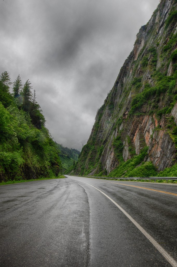
The road through Keystone Canyon. It’s wider here with the pull off otherwise the canyon is narrow. This is the only land route in and out of Valdez.
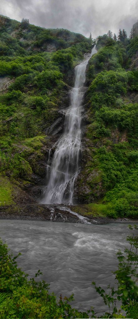
A vertical panorama made from 4 different photographs
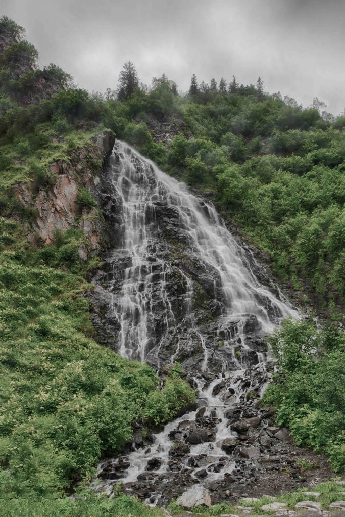
Panorama shot, again vertical, of one of the many waterfalls in this canyon.
Lowe River though Keystone Canyon
The headwaters of the inlet leading to Valdez. The land across the marsh is the site of Old Valdez which was destroyed with the Good Friday Tsunami in 1964.
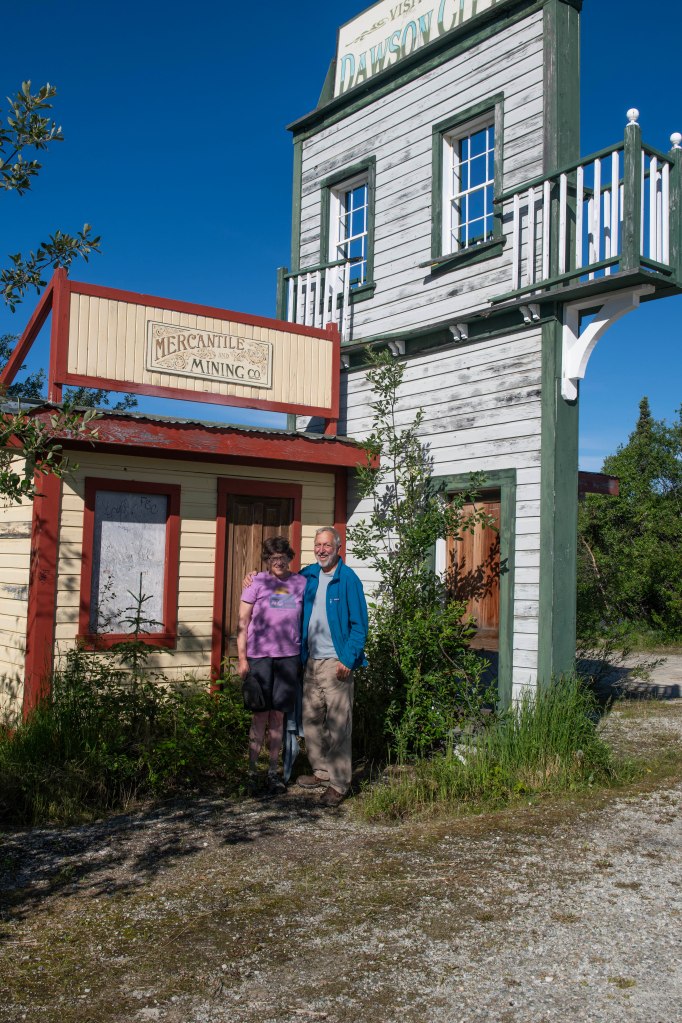
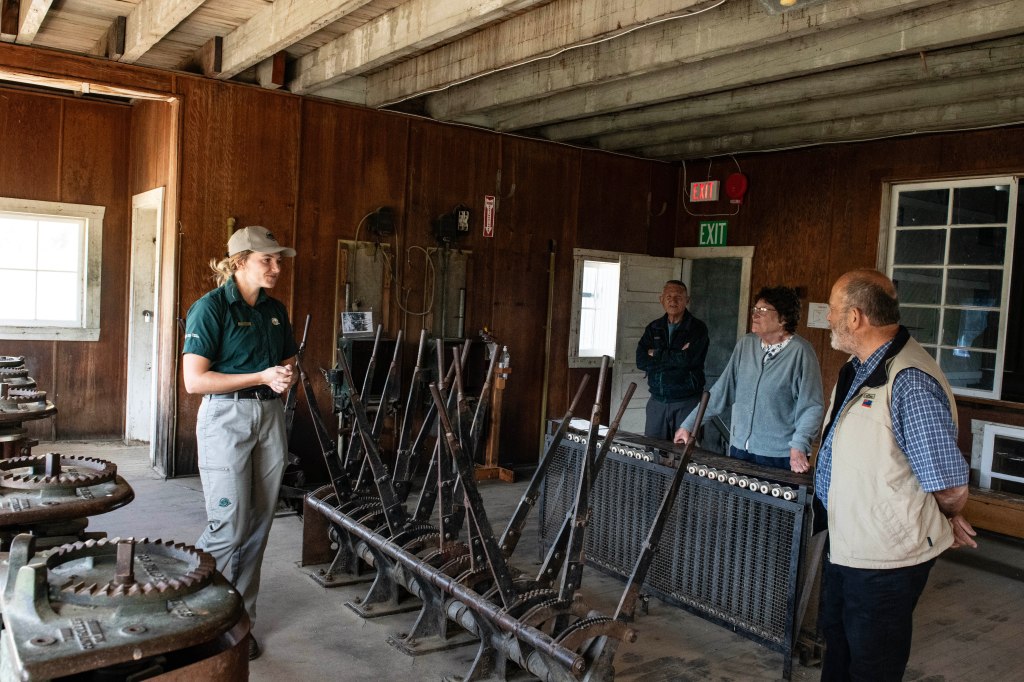
When thinking of Valdez what jumps to mind? The Exxon Valdez Oil Spill? Maybe the disaster tsunami that destroyed the town back in 1964? Those were two huge events placing Valdez on the map, but there is so much more to this town. As Alaskan towns go it is larger than most with roughly 8,000 residents. Employment includes the oil industry, fishing industry, and tourism. The port accommodates some Alaskan bound cruise ships but not many, so the town is not overcome with each new docking.There are two glacier/wildlife sightseeing cruises out of Valdez. There are plenty of adventure activities available as well.
We are here for a full week so don’t expect a new posting for each day. We arrived on Sunday. Monday was a workday including getting the truck oil changed. With the dusty road into McCarthy and back the truck’s tailgate latch gummed up and would not open. We cleaned and lubricated it so it’s working fine for now. Who knows once we hit another dusty road. We explored town on our bikes plus checked out a few places outside of town.
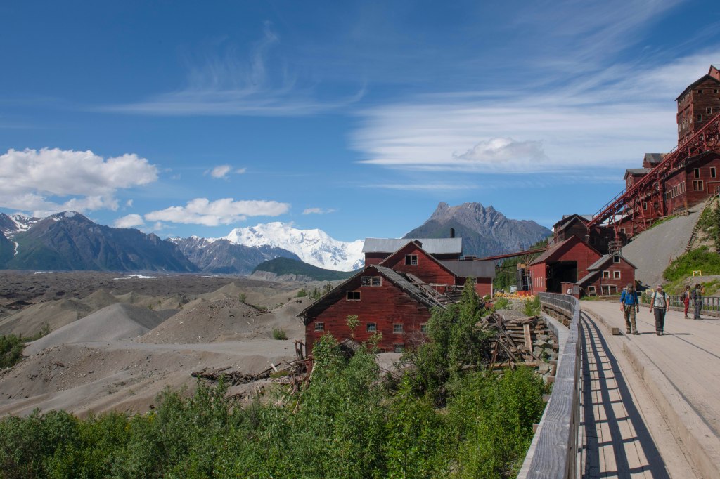
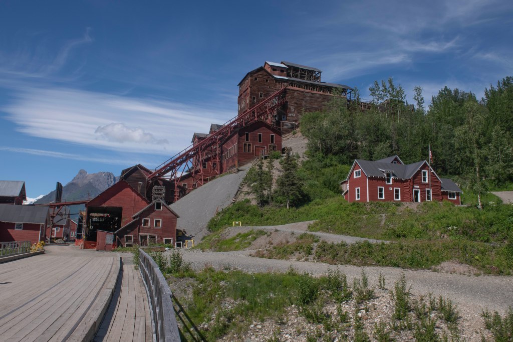
All roads lead to McCarthy. In truth, only one road leads to McCarthy. McCarthy is at the end of a 77 mile gravel road. McCarthy is the town and the Kennecott Copper Mile is two miles out of town. The existence of the town is due to the copper found in the area. Known by the natives for many year and the mining began in 1917 and closed in 1938. The coper ore found at the mine was roughly 70% pure copper. The mine closed since the ore remaining contained roughly 4% copper. With today’s technology copper can be mined at a profit with less than 1% copper. This area is no longer mined since it became part of the Wrangle-St. Elias National Park, the largest of all our National Parks.
Let’s start with the road. The road was built mostly on the old rail bed built to haul the copper ore to ships. It’s remote, rugged land and it’s hard to image living in McCarty, but some do. Some over winter in town but they are hardy souls. The highway, when open, provides some access to the outside world as does an airstrip. In the summer it’s home to National Parks personnel, local artisans, and ones supporting the influx of tourists wishing to experience the area.
The town includes a few eateries including The Potato, which we can now highly recommend. There are a few places with rooms as well as a large Inn. There are a couple of art related places as well as guiding services. The area is the starting point for those wishing to access the park via backpacking into the back country.
Once one arrives near the town there is a parking lot to leave your car. To get to town one walks across the foot bridge over the river then has two choices. Walk the half mile to town or take the shuttle running every half hour. There also is a shuttle from McCarthy to the Kennecott Mine 2 ½ miles further away.
After exploring Kennecott Mile and McCarthy we walk back to the bridge and pile into our truck. It’s a long and beautiful drive back to our camper where we boondock for the night.
Along the McCarthy Road
Most of the McCarthy Road was built upon an old railroad bed. Here’s one place where the road was rerouted to follow the contours of the land where it would bee too steep for a train. I’m glad we are on solid ground!
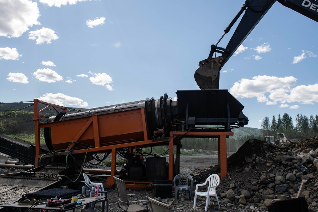
The couple in the next campsite from us tried their hand at panning for gold in the creek right behind our campsite. For their efforts they were rewarded with finding two small pieces of gold. It was fun to see.
We got off around 8 am with our first stop at the Post Office, yes Chicken has a Post Office during the summer. The summertime population swells to about 140 people but in the winter there are about a dozen hardy souls living here. The road coming in from the east from Dawson, the Top of the World Highway, is closed in winter as the road coming up from Tok. This place is isolated in the winter. No plows, no mail, not much of anything. The town survives on gold mining and tourists. All of that stops in winter. There is an airfield so it’s possible to get in during winter but it’s not easy.
The Taylor Highway is primary road to Chicken when it’s open. It’s not a road one can travel on with much speed. Sure, it’s paved, but the list of signs we noticed on the 75 mile drive to Tok included bumps, bump, dips, dip, construction, loose gravel, and damaged road. Just don’t expect to make time on this road.
We reached Tok and fuels up and grabbed supplies. Then on the recommendation of Kathe, a friend that lived in Fairbanks, we stopped at Fast Eddie’s. It’s a great stop for a meal. We highly recommend eating there.
We are at a small State Recreation Area camped. Along comes a couple and they ask, “Where in NYS are you from?” I reply, “How well do you know NYS?” The woman says very well. So I tell her Sherburne and her husband responds with, “Not the well.” Turns out they know much of NYS. I asked them where they lived and respond with Long Island on the Nassau/Suffolk border. Then she adds, but I grew up in Greenport. That’s the North Fork where I grew up. She went to Greenport High School and I Southold. It’ a very small world. The guy captained the party boat that took my High School 40th reunion class on a cruise.
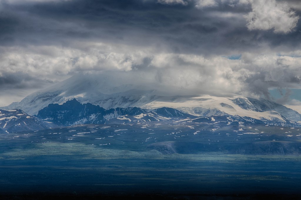
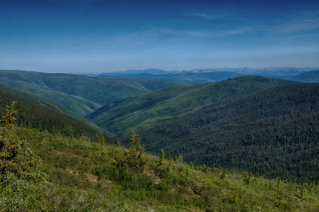
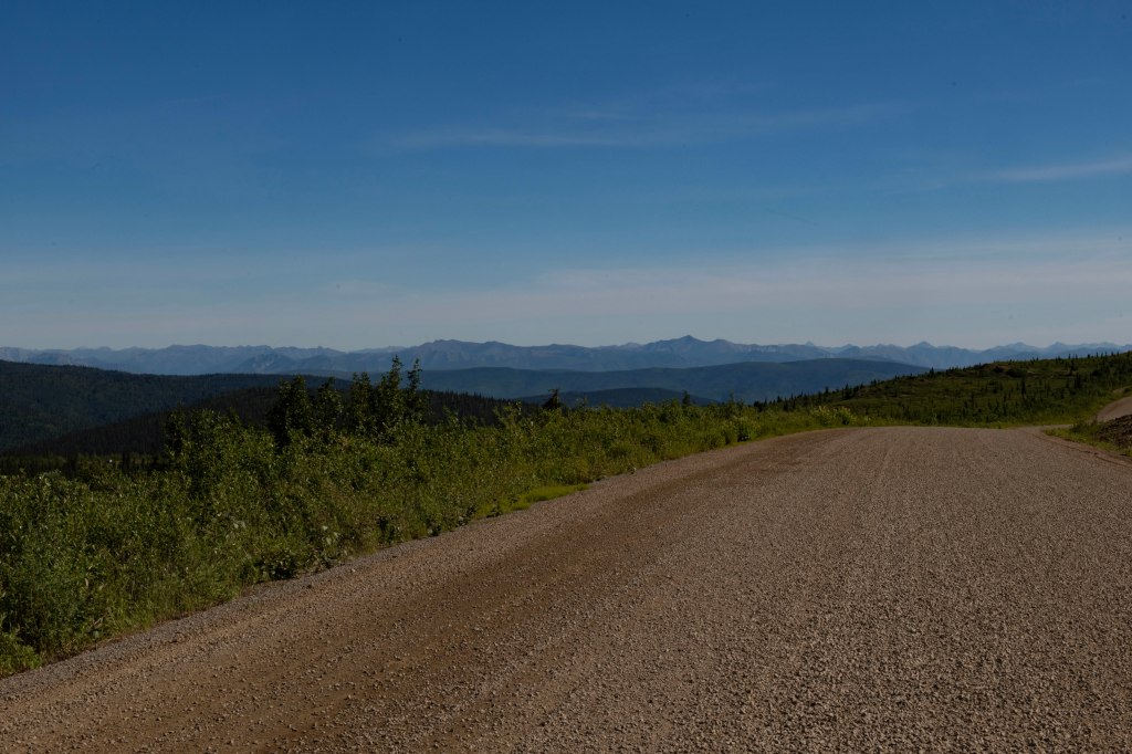
In the morning we pack up and head out. Today we tackle the Top of the World Highway that travels along a mountain ridge line between Dawson City and the Alaskan/Yukon Border. The unpaved road is open only in the summer months. We’re not sure when it opens for the season or closes in the Fall. Guess is it’s dependent on weather. Dawson is roughly at 1,000 feet above sea level and the road climbs to over 4,200 feet at one point while most of it is at 2,900 to 3,500 feet. It travels through remote landscapes above the treeline with no services. Oh yea, it’s not paved. We’ve traveled on other remote North American roads including the Dempster Highway going to Prudhoe Bay on the north coast of Alaska and the Trans Labrador Highway transecting the Labrador section of the Province of Newfoundland and Labrador. The last one has since been fully paved. These three highways are adventures onto themselves.
There are absolutely no guard rails with plenty of 1,000-foot drop-offs. The mechanic we saw yesterday warned us of soft shoulders and that he would be the one to tow us out if we went off the highway. He did not wish to have to do that.
Surprisingly, the road was mostly in outstanding condition with not much dust. We stopped along the way and even found snow still on the side of the road. This was not plowed snow, simply snow that fell or drifted there.
In approaching the border, we remembered when we last crossed at this crossing. The US Customs Officer was rude and gave us a hard time about having a bag of oranges. We declared them, but he needed to lecture us on the evils of oranges coming into the US from Canada. We handed him the bag and he saw they were grown in the USA so he handed them back and still scolded us. As we talked about this, we wondered what the crossing would be like this time. It was the opposite. A person doing his job and being friendly. WE ARE IN ALASKA! We made it but there is nothing for 40 miles other than the border station. The first 13 miles are on silky smooth pavement but then the road turns to hell. Narrower, steeper, curvier, slower, and certainly more dangerous we crawl along the 30 miles to Chicken. We are staying here for the night.
Last night while pulling into the campground a new truck sound developed. Our 2011 F-150 has many miles and is tired. This morning we called a local mechanic and planned to have a quick look early this afternoon. Instead of heading to the ferry with our bicycles we elect to use the truck. Again, our campground is across the Yukon River from Dawson and there is a free 24 hour ferry crossing.
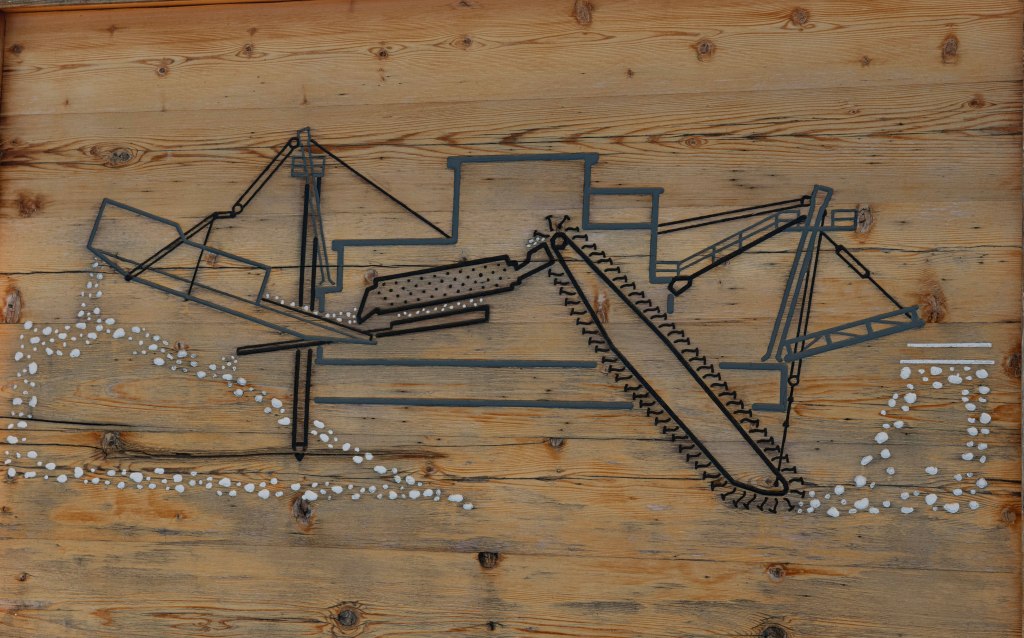
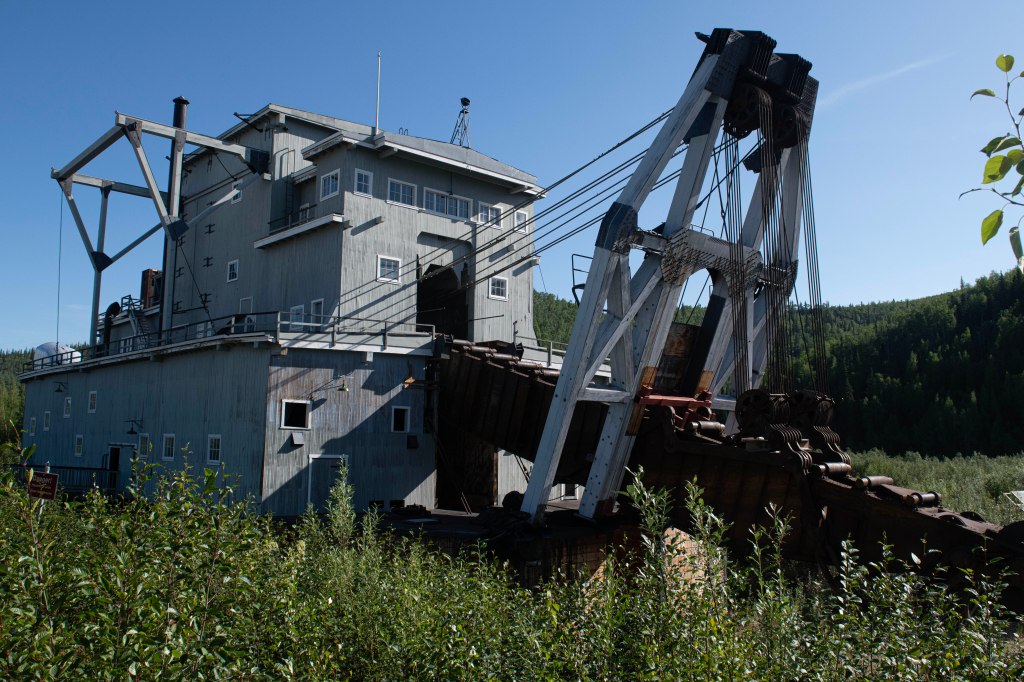
First stop is the Visitor Center where we secure tickets for a Parks Canada program about Dredge #4. Dredge #4 is 2/3 the length of a football field and 8 stories high with a displacement of 3,000 tons. It digs gravel and muck out up to 57 feet deep. It’s massive. It’s located up Bonanza Creek 8 miles and those 8 miles climb roughly 400 vertical feet. This monster dug it’s way up the creek by dredging a pond in front of it and filling in behind it gaining elevation in a way like a canal lock.
The way the dredge operates is by dredging the gravel and muck in front of it sending the mess through a sluice like tumbler/screen separating the heavier gold from the lighter rock and muck. In operation beginning around 1910 and finally ending in the 1960s the dredge extracted millions and millions of dollars of gold. It’s now a Parks Canada National Historic Site.
After the program we head further up the creek and come across Discovery Claim. Here’s where three prospectors were heading back to Dawson with their supplies running low and one of the men shot a moose. He then stopped at the creek for a drink. There he spotted gold. It was August 1896 and the rest is history.
Next, we drive up Dome Road that climbs a couple of thousand feet above Dawson City for a view of the land. After that it’s time to make our appointment to assess the truck’s new noise. Chief Isacc Mechanic Garage was our stop and he assessed our issue. It’s neither a safety issue not likely to leave us stranded on the roadside. We thank him and head into town for lunch. Great lunch at the Bonton. Now to walk around town. With a stop at the local market we meet a friendly woman and after a short chat we are invited to tour her family’s gold mining operation. It was amazing.
A fun day and now we head back to the campground for supper and cribbage. Oh, yeah, also to complete this blog.
Dredge #4 digs the material from the front and deposits tailings in the rear moving forward maybe 10 feet each day. It digs out a wide swath to a depth of 57′.
Dredge #4 at close to 200′ long it is the largest dredge of its type in North America. This type of dredge was first developed and used in New Zealand. Many of the components of this dredge were built in Maron, Ohio.
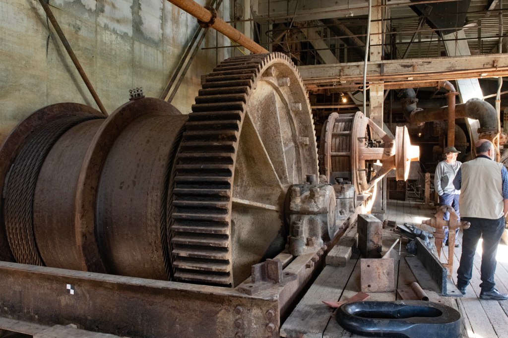
These large gears pulled cables designed to move the dredge forward and side to side.
The control room for operating the dredge. The dredge was operated with four people onboard. The dredge was run by DC power. AC power was generated via hydro electric dams many miles away. The power went to a transformer to supply DC power to the dredge.
Looking out one of the upper floor windows of Dredge #4. Thars a Moose in thar pond!
Here is the site of Discovery Claim along Bonanza Creek where the gold rush started.
Here’s a currently mined family operation. The principles for extraction are just like Dredge #4.
The pit where the material is first dug. The material from here is brought to the hopper extraction device in the next photo above.
After getting a great sleep we are up and ready to hit the road. With roughly 180 miles to go with Dawson City as our goal we take off. The highway is empty of anybody and it’s 30 minutes before we see another vehicle. With a speed limit of 90 km/hr there is no rush. For those unfamiliar with the metric system the speed limit works out to 57. To date road construction has been minimal with the occasional temporary bridge or small sections of pavement being replaced. Today we encounter several stretches of construction, some with pilot cars and some without. It’s dusty and bumpy in these sections so we slow down to about 20 mph keeping both the dust down and our teeth intact. We are hit with a few showers that help mitigate the dust and arrive in Dawson City sometime after noon.
We see no wildlife along our route yet still a great drive. Several miles before reaching Dawson City there are vast stretches of piled rock tailings. These are the leftover dredged stream beds from Bonanza Creek and maybe a few other area creeks. Bonanza Creek is where gold was first discovered in August 1896. Yes, this was the start of the 1898 Klondike Gold Rush. Note, it’s referred to as the 1898 gold rush yet gold was first discovered two years earlier. This is due to the remoteness of the area with the lack of any communication to the outside world. It took about a year for the world to hear of the wealth of gold simply waiting to be picked up off the ground. Newspapers around the world ran stories of the unbelievable wealth to be found. All one needed to do was to get up to the Klondike and become rich. The papers hyped it beyond imagination.
What was not mentioned were the difficulties in getting to the gold. Reportedly, there were three options. One would be to take a ship to the beginning of the Yukon River and arrange to travel upriver for over 1,000 miles via paddle-wheel steamer. Sounds easy, but the papers never mentioned the Yukon River flows freely without ice for only part of the year. Additionally, this was the expensive route in terms of capitol outlay. The second option was to take a ship up along the Canadian and Alaskan coast to a spot on the map called Skagway. Upon arriving in Skagway it was a simple hop over a pass, there was a choice of two passes, White Pass and Chilkoot Pass. Once over either pass build a raft and simply float down the Yukon River to Dawson City. Piece of cake! More on that in a bit. The third option was an overland route from Edmonton, Alberta. It was easy to get to Edmonton since it was serviced by train. A train ride to Edmonton and a short jaunt to Dawson. That short jaunt involved about 2,000 miles over trailless wilderness. Only a handful of hopeful miners successfully traversed this route.
Time to focus on the second option, Skagway. The two passes commencing near Skagway crossing the rugged coastal range are White Pass and Chilkoot Pass. The trail up White Pass started on the outskirts of Skagway while Chilkoot Pass required one to travel eight miles or so along the shore to another settlement, Dyea. This was the start of the Chilkoot Pass. Both passes were extremely difficult and many people lost their lives attempting to cross the pass. At the top of both passes lay the border between the United States and Canada. Stationed at each border crossings stood Canadian officials, The Northwest Mounted Police. They would not allow anyone into Canada until the individual presented over 1,000 pounds of supplies. The supplies would be needed for the would-be miner’s survival. If you have ever seen any of the photographs of vast lines of people trudging up a snow laden trail that was how the people traversed. Thye had arrived with some supplies and anything else they needed they had to purchase in Skagway. The lawless frontier town of Skagway was run by a criminal, Soapy Smith. He ruled the town. Either he or his henchmen robbed the miners blind and murdered many of them.
Once one got out of the clutches of Soapy Smith it was time to haul their goods up the pass. While Skagway was lawless, law and order was highly maintained on the Canadian side. The Mounties would inventory each person’s supplies. Many would be miners died attempting to haul their goods up either of the passes. Near Dyea there was an avalanche that killed many on one day in the spring.
Once the necessary supplies reached the border the miners were allowed into Canada and head down to a waiting lake. Once at the lake the task was to build a worthy enough raft to make it down the Yukon. The Mounties monitored the river worthiness of each craft. The float down to Dawson was not without hazards. At difficult river rapids the Canadians were there to safeguard the miners. Many needed to portage around the rapids.
Finally, those who completed the long and difficult journey arrived in Dawson City only to discover all the potential gold producing claims had been claimed leaving most who arrived unable to afford to leave. Dawson was a wild and rough town with plenty of drinking and partying. After only a couple of years most managed to leave town. Some lucky ones ended up reaching Nome where they struck it rich on the beaches of Nome where another gold rush commenced.
Enough about Dawson City today. We are now camped across the Yukon River from Dawson City. Our plans are to spend a few days around Dawson City then head west along the Top of the World Highway.