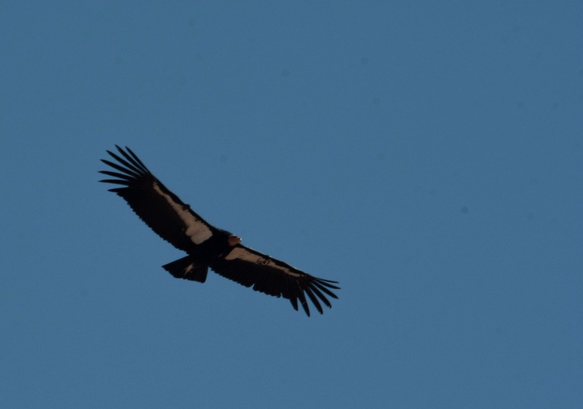
We putz around the camper for the morning with plans to head out to see California Condors later in the afternoon as they come in to roost. We have no clue if we’ll have any success but what the heck. The site to observe them is along US 89A at Navajo Bridge near Lees Ferry between Page, AZ and The Grand Canyon. The narrow bridge needed to be upgraded to accommodate additional traffic so a new highway bridge was built next to the old bridge and the old bridge became a pedestrian walkway and viewing area. Several California Condors use either of the bridge’s trusses or the neighboring canyon walls as a place to roost. Additionally, two years ago a pair of condors placed their nest there and raised a condor chick in the wild. This excites all since this means that there are condors being hatched both in captivity then released into the wild and condors successfully being hatched in the wild.
We see at least three condors but potentially another 3. It’s hard to count condors as they move around!
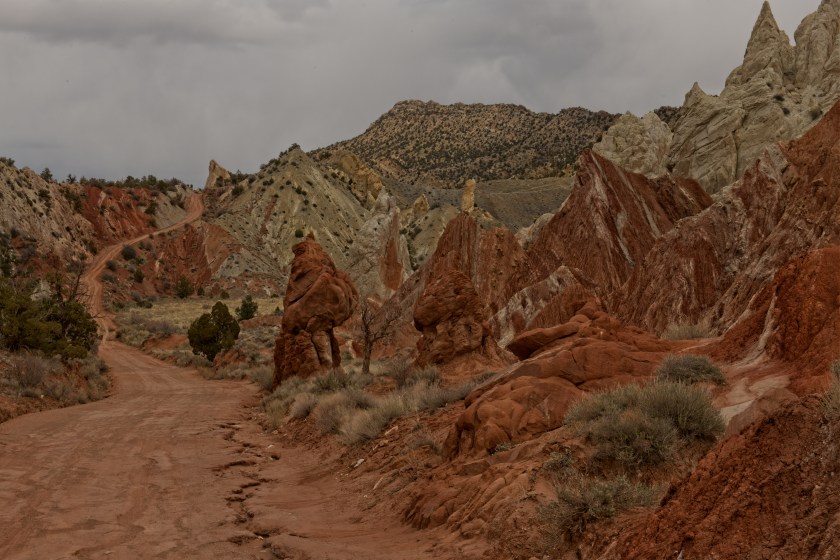
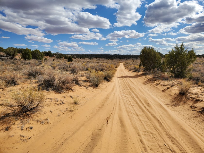
White Pocket is our destination today. It’s an emotional journey that we’ve done twice before. It’s 12 miles south of the Wire Pass Trailhead. Well, that is the start of the 20 miles of one lane sand road. It’s emotional because on our first time heading into White Pocket 3 years ago it was about the same time of year, but the previous December we lost our son, Max. Neither of us have many memories of the period from his death to when we were heading to White Pocket the first time. As we were driving along the 20 mile one lane sand road Marsha said, “Max would have loved driving on this road.” Where Wells replied, “Yes, but we would NOT want to be in the vehicle with him!” This was the first major healing point for us. We both could laugh and fond memories of Max flooded to the surface.
One of the few straight sections of the Sand Road
White Pocket is much like The Wave but does not require a highly sort after permit. No permit is required to go to White Pocket, but a high clearance 4 wheel drive vehicle is absolutely necessary. Without such transportation the other option is to hire a guide from Kanab to take you in. Both are viable options.
We decide to come in from the south from US 89A to reach White Pocket. It’s accessible from either US 89 or 89A halfway between Kanab and Page but the route from the south has about 10 miles of gravel road before the dreaded sand while from the north it’s 30 miles of gravel road and not easy gravel at all. From the south brings us past the Condor Release Viewing Site. We’ve seen tiny black dots way way up on the cliffs last year and don’t think it’s worth the stop to see black dots, AKA California Condors again this year. We stop just for the pit toilet, but there is an ornithologist there who works for the Peregrine Fund who oversees the Condor release program. As we chat with him we spot several Condors that are way bigger than tiny black dots. Moreover, a couple of the birds soar and get much closer! We have great views of the Condors.
California Condor
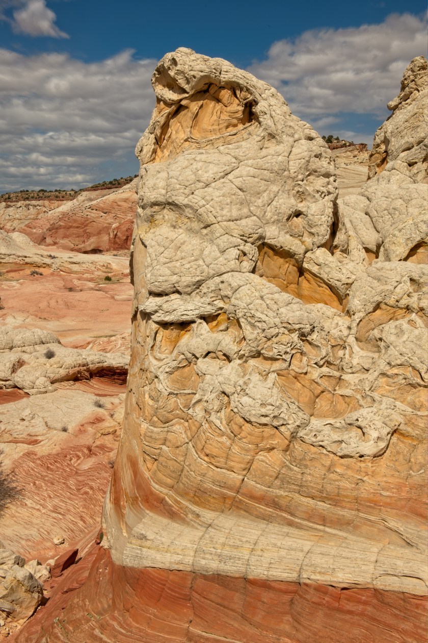
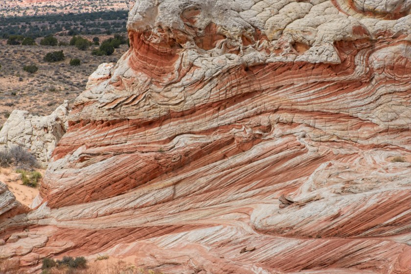
On to White Pocket. We arrive earlier in the day then our previous two times here so we have more time to explore the roughly 1 mile by ½ mile intense rock formations. Area wise it’s considerably larger than The Wave. Exploring the rock shapes and sculptures lends more creativity to photograph here verses The Wave.
White PocketWhite Pocket
After several hours we head back and stop again at the Condor Release Viewing Site. There are three more people associated with the Peregrine Fund helping the Condors. The project director, Tim, and two volunteers. They suggest another location where we can see California Condors much closer. We store that information, thank them, and head back to Kanab.
Today we are off to explore Wire Pass, an area with a slot canyon. We’ve hiked in on the Wire Pass trail last year but we turned around when we reached a place in the slot canyon that includes climbing down several feet on a rickety makeshift ladder. This year the ladder no longer is in place, rather there is a rock scramble up out of the slot canyon and back down into it. We have no clue how easy or not the scramble is so we are off to find out.
After the hike to the slot canyon we reach where the ladder once was, turn around and find the place to scramble out. We manage to scramble up but when we see what we need to scramble down to get back into the canyon we make the choice to turn around and head back the 75 miles to our campground.
It’s a long drive to our trailhead for today at about 160 miles each way.
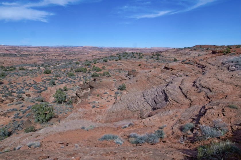
Hole in the Rock Road follows an old Mormon Trail beginning near Escalante. The trail first blazed around 1880 included having to lower wagons down a cliff to where the Colorado River could be crossed. Today the road lends access to many hiking opportunities including several unique rock formations, arches, canyons, and slot canyons. We are here attempting to explore three or four slot canyons including Dry Wash, Peek-a-boo, and Spooky slot canyons. We don’t know lots about access to these canyons other than the preferred access for Peek-a-boo and Spooky is to start in Peek-a-boo and exit via Spooky. Also, we know that entrance to Peek-a-boo involves a scramble up a 15 foot rock face with small footholds in the rocks. We don’t know if we can access it but we are attempting it.
View down into Dry Wash where the slot canyons are found
The trail is close to 30 miles in on the gravel road and we hardly see any signs of other people. Upon reaching the trailhead there are around 20 cars so we know this is a popular hike. There is plenty of space so we have no problems.
The trail down to the wash where the slot canyons can be found is a couple of miles and at one point heads down along slick rock at a steep angle. If one falls from here it’s maybe a 50’ freefall. It’s rough going and maybe it is at this point we realize that everyone we have seen today is under 30 years old…. Hmmm..
We do make it down to the bottom of the wash and hike to the entrance to Peek-a-boo. That 15’ scramble up the rocks has nice but very small footholds. Our boots do not fit in the footholds so there is no way we are making it up there. Instead we elect to head to Spooky where we would normally exit after going in via Peek-a-boo.
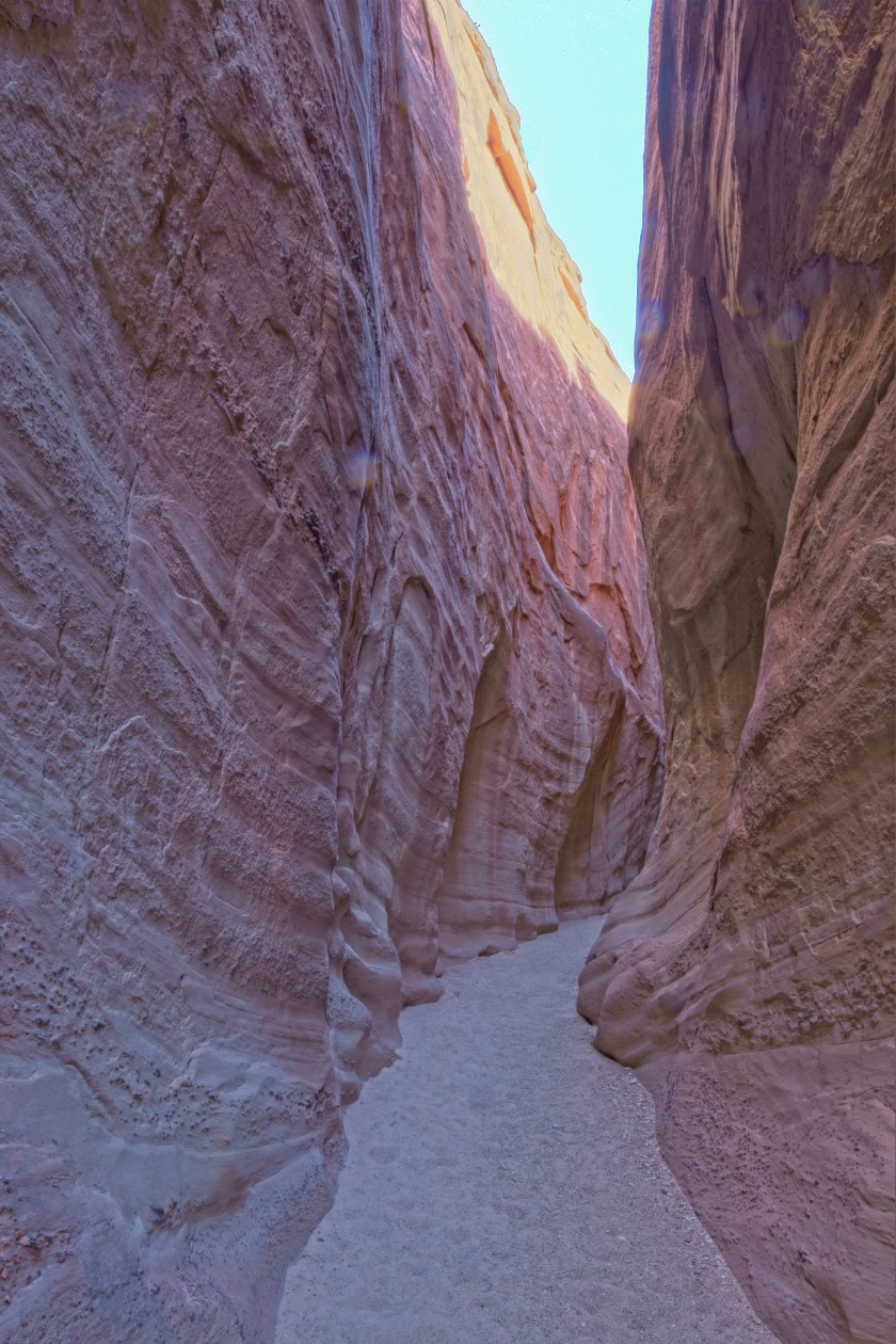
Once we get to Spooky we begin to understand how this slot canyon got named. It is narrow and dark. We find ourselves crawling at times while at other times we squeeze though the many narrow sections. While moving forward and turned sideways both of us are scraping both sides of the canyon walls at the same time. There are times that we wonder if we are going to be able to squeeze through further. It’s so narrow that Wells only manages to capture one photograph and that was at one of the few wide points.
A Wide Section of Spooky
At some point we turn around and make it out to the open wash once again. The third slot canyon is way wider so we can get a few photos.
After finishing the hike out we are beat. Now for the long drive back to the camper and a good night of sleep.
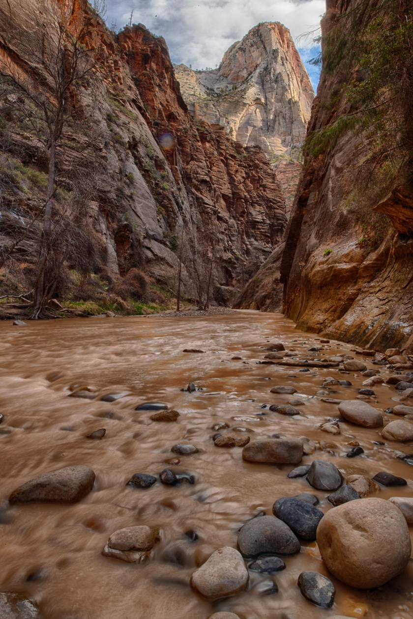
Knowing Zion is open and uncrowded we elect to head back. Rumors are flying that the Park Service is going to close Zion and Bryce any day now so we need to explore Zion today. Heading in from the east entrance again we see many Big Horn Sheep. Then it’s down into the canyon floor where we head onto the road normally closed to private vehicles. We head to the end of the road and do the Riverside walk to the start of the Narrows Trail. The trail follows the Virgin River upstream for a ways until it ends with the canyon narrows and the only way to head further is to hike upriver in the river. The river is not very deep but is cold and rushing. It’s the color of chocolate milk from upstream runoff.
The Narrows – Virgin River
At the beginning of the Narrows Trail along comes a family of six with the youngest girl younger than ten. They are decked out with water shoes and the appropriate water traveling gear available for rent at a outfitter just outside the park. After a nice chat they head upstream and around the bend of the narrows. Their family adventure warmed our hearts.
After a couple of other short hikes we head back to Kanab again passing the Big Horn Sheep. This time we see a couple of dozen.
We hear the Bryce National Park and Zion National Park are open so we head out for Bryce. For those of you that have not traveled to either Bryce or Zion the word is in Bryce you look down and in Zion you look up. Hiking in Bryce starts at the rim and proceeds into the canyon while at Zion most hikes start at the bottom of the canyon and hike up. At Bryce road access is at the top of the canyon. Elevation here is quite high with road access topping out at over 9,000 feet. Our plan is to hike down into the canyon. As we climb in elevation there’s more and more snow and it becomes evident that the trails into the canyon are either closed or we do not have the right gear to hike down the narrow steep trails which are covered with snow and ice.
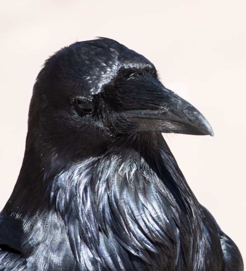
We take multiple stops along the way and see no other cars with one exception. At one of the viewpoints we stop and are harassed by a Raven. This brash guy is not intimidated at all by us and approaches within two feet following us around begging for food. At we know better than attempt to feed the Raven so we don’t. At this point a Park Ranger drives by. Seeing the Raven so close to us she stops and pulls into the parking area. “Are you feeding the bird?” She asks. We tell her what happened and this leads to a wonderful chat with her about her love of this and many other National Parks. Her dad was a park ranger and she is following in his footsteps.
Brazen Raven
We elect to explore the rim top then turn around and head out of the park. With still time on our hands we head over to Zion to at least check it out. Normally, we don’t enjoy Zion since it is crowded. The primary access into the canyon is via shuttle bus and the lines to get onto one of the shuttles can be daunting. We don’t have high expectations but are just going to check it out.
Bryce National Park
From the eastern Zion entrance is somewhat high at up to 7000 feet. The road descends traveling via a long tunnel then a series of switchbacks down the canyon wall to the bottom below at just over 4000 feet. Before the tunnel we observe several Big Horn Sheep and one briefly poses for Wells. There are not many people here so we are encouraged on what we could expect at the canyon floor. We pass though the tunnel and down into the canyon. To our surprise the shuttle is not running and access to the road normally closed of to private vehicles is open to us. Since it’s late in the day we do some scouting of the valley and determine although all services are closed the park is open and not at all crowded.
It’s been a long day and it is getting late so we head home. Again we pass by the Big Horn Sheep as we head east towards Kanab. Arriving late to the trailer we elect to do take out from a local Mexican Restaurant recommended by a friend back home. It was good!
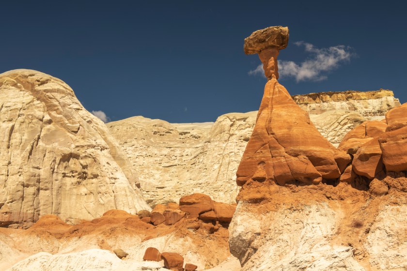
We are planning several days of activities while staying in Kanab. Like yesterday we head east towards Page, AZ. We take a hike to the Toadstools which are mushroom like rock formations. The hike starts out following a sandy wash for a while until we come to the Toadstools. We encounter a few other hikers but for the most part we are alone. After a picnic lunch we return to the truck and do some scouting for tomorrow’s adventure. Back to the highway we head a few miles west to House Rock Road. It’s is a 40 mile long dirt/gravel road that connects US 89 and US 89A both of which connect Page with Kanab. Along here are trailheads for Wire Pass and The Wave.
The Toadstools
Marsha Social Distancing with Toadstools
The Wave is not a place we are going to this year. It’s a rock formation which does look like a huge wave. Over the past 15 years this destination has been overwhelmed with popularity mostly due to people posting photographs on social media such as Facebook and Instagram. The BLM (Bureau of Land Management) restricts the number of people going to The Wave to 20 on any given day. Permits are granted via two lotteries, one online and the second in person at the BLM Information Center in Kanab. The online lottery is held three months in advance with only 10 slots per day. Everyday the number of people attempting to gain one of these slots is one to two thousand. Last year we applied to the in person lottery at the BLM office where there are typically 100 to 200 people trying each day. Since the Pandemic the BLM Office is closed and they discontinued the daily lottery. Therefore, only the online lottery winners have access to The Wave. Fines for being found there without a permit are high to discourage others from trying. With the Pandemic they are still patrolling the area so we are not considering sneaking in. Besides, it is a 6 mile round trip hike and there have been deaths with people getting lost there or not carrying enough water.
At the trailhead for Wire Pass we chat with a Ranger that gives us a few ideas on where to explore. We plan adventures to Wire Pass and White Pocket for later in the week. We continue south on House Rock Road for another 20 miles until hitting pavement on US 89 A. House Rock Road can be driven with a two wheel drive car but it can be dicey. It’s best done on a high clearance 4 wheel drive. When wet the entire road becomes impassable due to mud, lots of mud! The access road to White Pocket begins on House Rock Road and is a twenty mile one lane sand road. This is not to be done without a high clearance 4 wheel drive vehicle. There are plenty of warnings to know the difference between 4 wheel drive and All Wheel Drive (AWD). AWD is not enough for the road into White Pocket.
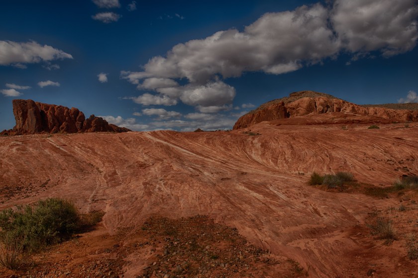
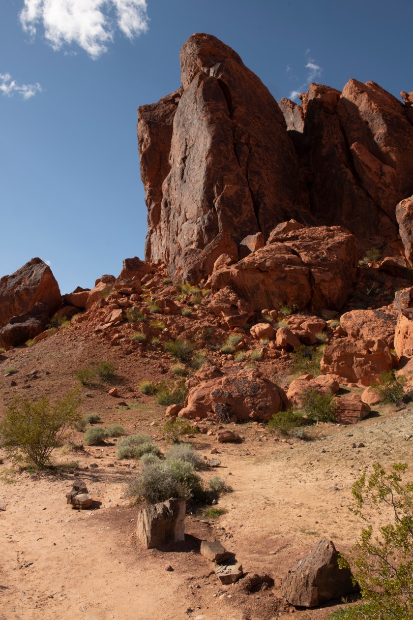
Prior to Kanab we did detour a bit which story has yet to be told. That omission is addressed now. Upon leaving Bullhead City on the Arizona/Nevada Border we head to Valley of Fire State Park in Nevada a bit more than an hour northeast of Las Vegas. This is Nevada’s oldest state park and the setting for many movies over the years. It’s a surreal landscape filled with contorted rocks of many hues including whites and reds.
Valley of Fire State ParkValley of Fire State Park
Our first drive into the park was a quick scouting trip for us to determine what hike to take tomorrow morning prior to pushing on to Kanab. Once we figure out which hike to take tomorrow morning we have time for another hike this afternoon.
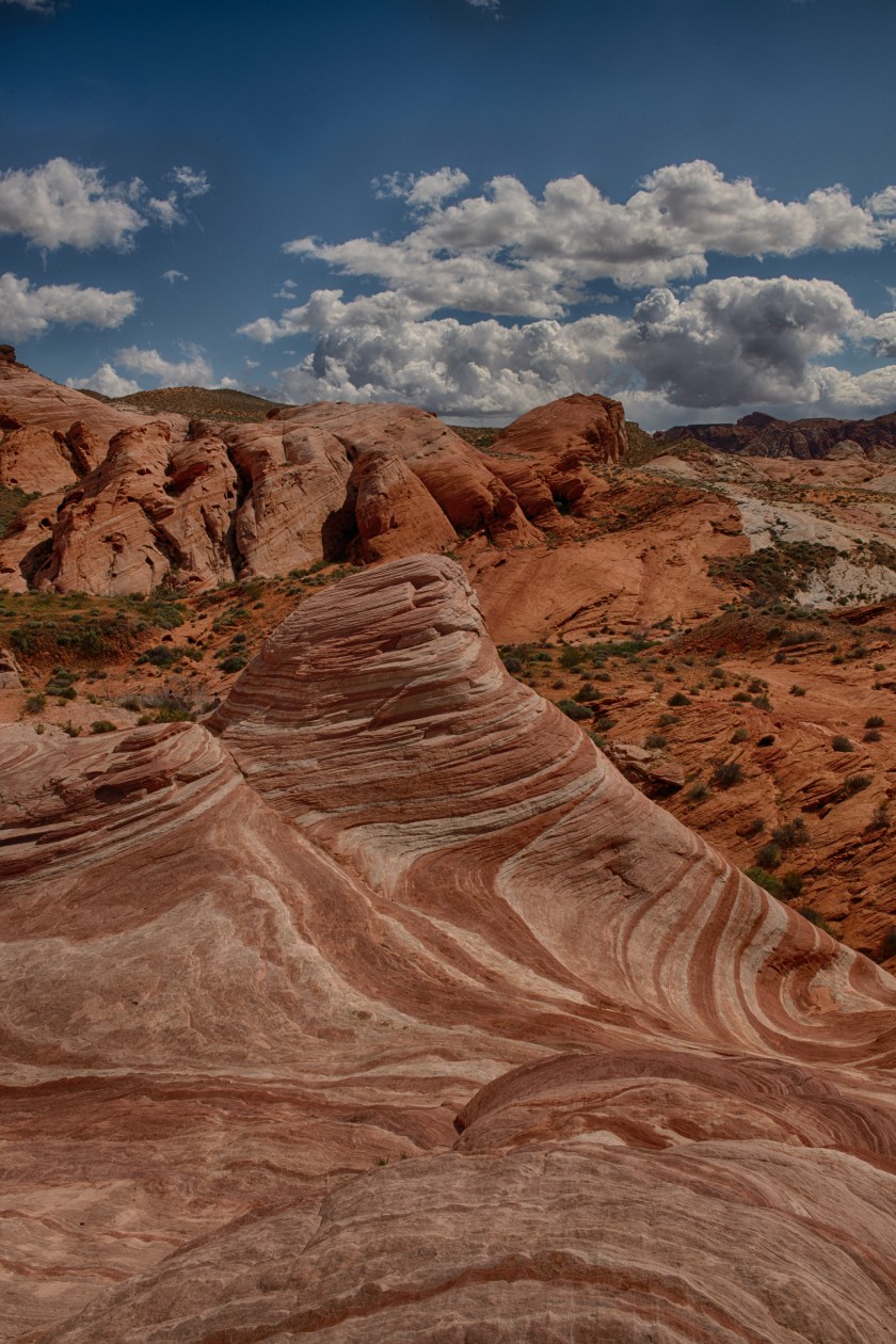
Wave of Fire
It’s to the Wave of Fire while Mouse’s Tank is what we decide on for the next morning. So now it’s time to find a boondocking site for tonight. We travel east of the park and a couple of miles outside the park boundary where there are plenty of options. After a restful night at the boondocking site we head back into the park and do Mouse’s Tank. On our way into the park we spot a Bighorn Sheep that briefly poses for Wells. Big Horn Sheep
Later in the day we drive to Kanab.
Out west sometimes there are no options for routes other than Interstates. We are on the Interstate that travels from Las Vegas to Salt Lake City. We need to be on it for about an hour until just beyond St. George, Utah. We come across traffic slowed due to an accident on the highway. The emergency and fire departments are just arriving. We see a pickup truck/big RV trailer/small following trailer wreck. The two trailers had somehow jackknifed and rolled. It’s a reminder to always always always have a tow vehicle correctly sized for what you pull.
We push onward and arrive late in the afternoon at Kanab.
Our plan is to use Kanab as a base for a week or so as we explore some of the surrounding areas. Today our plan is to drive to Cottonwood Canyon and see what we can find. Cottonwood Canyon road leaves US 89 heading north for high clearance vehicles. Road conditions vary widely throughout the year so at times 2 wheel drive is fine yet other times 4 wheel drive is needed. No matter 2 or 4 wheel drive, high clearance is necessary. A few years ago Wells drove it with a Subaru Forester with no issues. Cottonwood Canyon Road is roughly 44 miles long where one hits pavement again and is at the entrance to Kodachrome Basin State Park. Here is where National Geographic intensely explored the area many years ago.
Driving on this road is not a speedy happening. Our speed rarely gets up to 20 mph and more often in the 10 to 15 mph. This is fine since the landscape is stunning and highly variable. You never know what new sights are around the next bend.
Cottonwood Canyon Road
We settle on a hike into a slot canyon and marvel at what the power of water can do. The hike starts with a bit of a scramble down to the stream bed then it’s mostly flat walking on sand. We see that recently it had rained. There’s plenty of wet sand but no visible water. The walls of this narrow canyon extend upwards several hundred feet and the width varies from 8 feet wide to 25 feet wide. This is not a place to be caught during a rain storm. There are few escape routes to get above the water.
After the hike we continue driving north on Cottonwood Canyon Road until we finally hit pavement once again and we head into Kodachrome Basin State Park. We don’t expect to get in since the Utah Governor issued an order yesterday stating that all Utah State Parks are open only to residents of the county in which the state park is located. We drive up to the entrance gate and the person there asks if we are coming in. We reply, “Can we?” to which he responds “ten dollars.” We are in!
It’s late in the day and we have a long drive to return to Kanab so we elect to do two short hikes. The first is a loop that lets us explore two box canyons while the second is a .6 mile nature trail where Marsha wants to read each and every interpretive sign. There are many!
Kodachrome Basin State Park
Now it’s back to the road where we have a two hour drive back to Kanab via paved roads. Along the way we pass near Bryce National Park then Zion National Park. While passing Bryce National Park we see snow along the road side as well as running into a few snow showers. Around these parts temperatures and weather conditions are dictated by elevation.
We arrive back in Kanab as the sun is setting. Our around the block adventure is just shy of 200 miles.
On packing up and leaving Organ Pipe Cactus National Monument we head north and west. It’s a travel day and we end the day in Bullhead City, Arizona on the banks of the Colorado River looking across the river at multiple shut down casinos. We attempted to get a spot in a RV Campground but the office was closed so we moved to an empty lot on the river along with a half dozen other RV’ers. In the Bullhead City area is where we first observe long lines stretching across a parking lot to get into a Sams Club.
The next omorning, we push onward with a reservation and goal of Kanaba, Utah. We arrive at the campground which is the same one we stayed in last year. Within a couple of hours of Kanab there are many things to do and they are mostly hikes. That’s our plan as we prepare to use Kanab as our base for at least the next week.


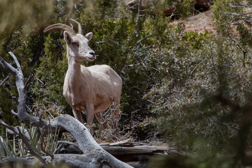


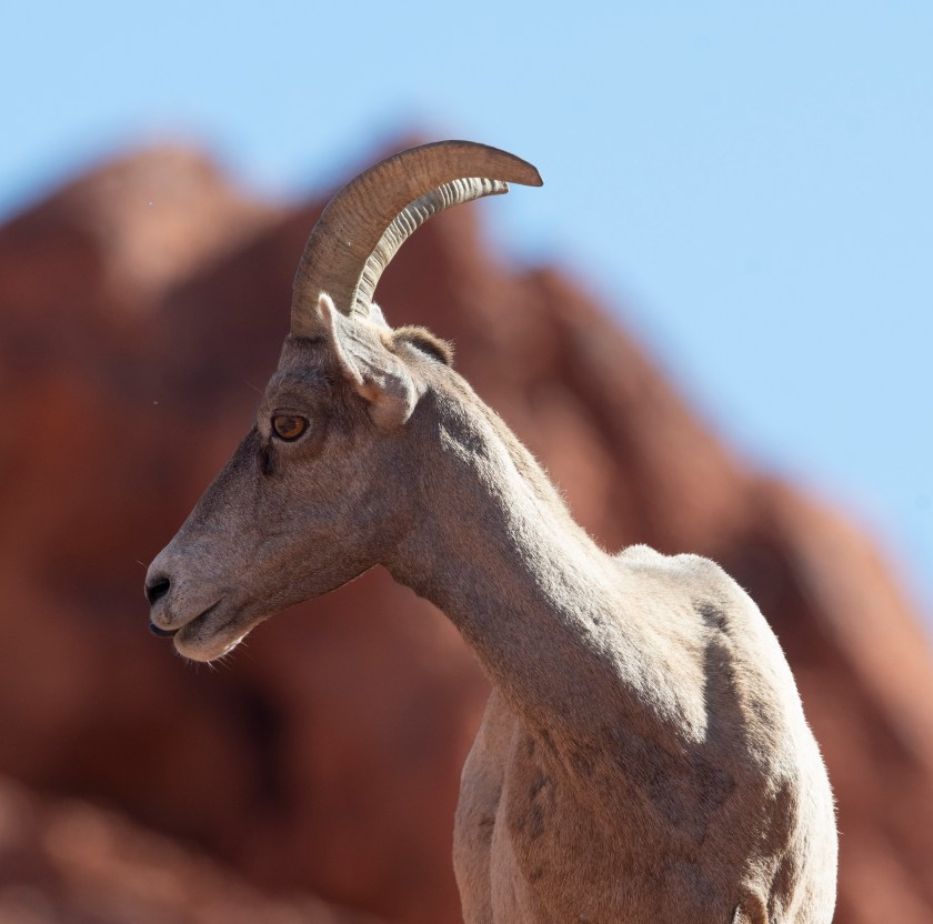 Big Horn Sheep