Day 14 – Teslin to Pelly River Crossing

What a night! The noise was constant, a buzzing in the ears that never stopped! We set up at the campground in town. A nice breeze and not an insect in sight. As we were playing our nightly cribbage on the picnic table we were a bit too casual in keeping the trailer insect free. During the third round of cribbage we needed to move from the picnic table to inside escaping the cloud of mosquitos that descended.

In the camper we found a few of the bloodsuckers waiting for us, but we took care of them. Time to hit the hay and there began the incessant buzzing. We both figured we’d take care of these few and all would be fine. It was not to be. For every mosquito killed another two would show up. It was as if their attack plan was to send waves and waves out. Neither of us got much sleep that night. It was well after midnight when both of us managed to fully doze off. We’d be up turning on the lights and attacking the enemies with fly swatters. Mosquito carcasses and blood splatters the various camper walls. Even at the first light of day, which by the way comes before 4 AM, the buzzing continued. Only once up and well supplied with coffee did we discover their egress into the camper. A sliding plastic cover fully closing the screen door was left open.

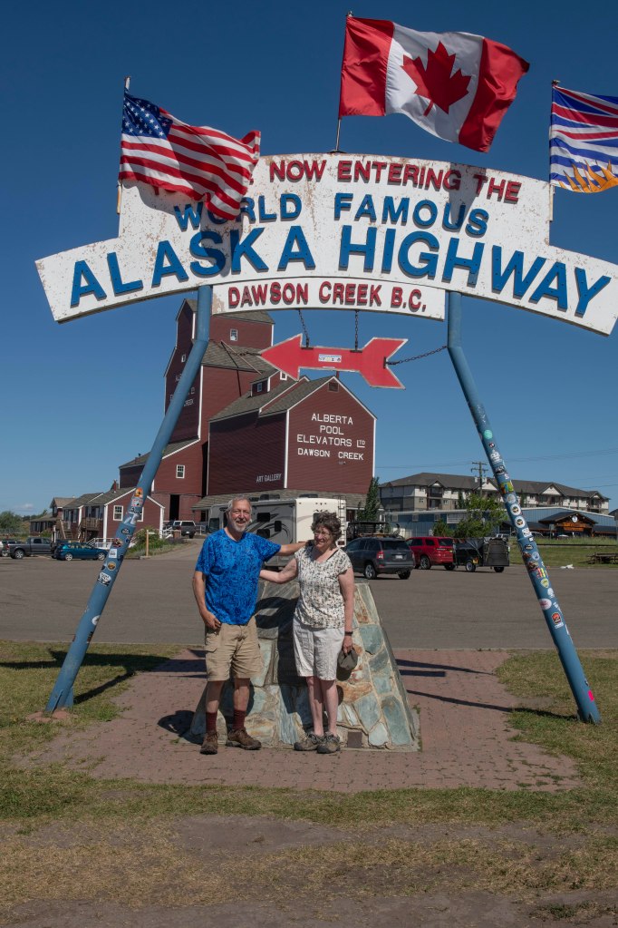
Now awake and highly caffeinated we get on the road heading for Whitehorse. If you’ve journeyed to The Yukon and Alaska before you realize that supplies can be a bit pricey and there’s often not a huge selection of goods. We found a large grocery store that did have a great selection at decent prices. Well stocked and fueled up we leave town continuing our trip.

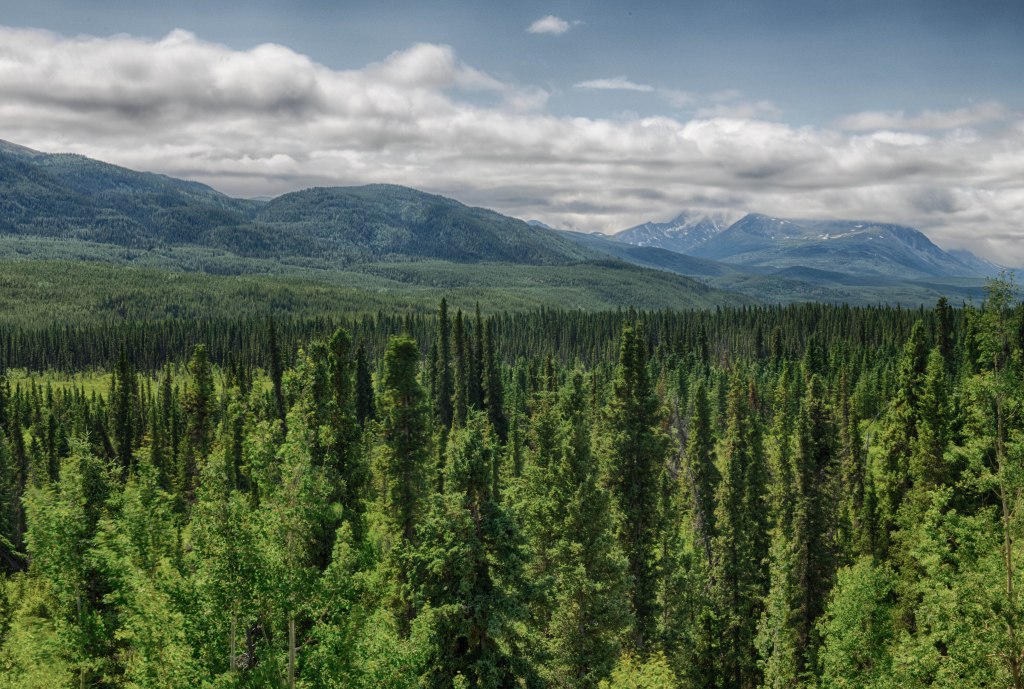
Shortly after Whitehorse we leave the Alaskan Highway electing to head north towards the town of Klondike Gold Rush fame, Dawson City, about 400 miles north. The section of highway from near Watson Lake to near Whitehorse there are no other options in driving to Alaska. There are two ways to drive from the lower 48 to near Watson Lake, the Alaskan Highway and the Stewart Cassiar Highway. The former travels closer to the Pacific Coast while the latter starts near the Alberta/British Columbia border. Once the Stewart Cassiar Highway reaches the Alaskan Highway heading towards Alaska there is only one way to go. Just beyond Whitehorse again there are two routes. The primary route heads west to Tok, Alaska while the secondary route heads north to Dawson City then onto Chicken, Alaska. From there one can travel on to Tok, Alaska.

After leaving the Alaskan Highway traffic diminishes. We still need to travel almost 400 miles to reach Dawson City so we look to doing about half of that today and the remainder tomorrow. In Pelly River Crossing we figure it’s a good time to stop. Seeing a campground sign we turn left just before the large bridge over the Pelly River. As we pull into the campground that’s along the river we see another sign, Camping Free. There are several sites all with fire rings, picnic tables, and pit toilets. A great find.

We retire for the evening prepared for and receive a buzz free night!

Day 13 – Laird Hot Spring to Teslin

As in previous days we see the occasional bear munching on the vegetation near the road shoulder as well as a few Stone Sheep. The sheep are after the roadside minerals such as salt. Unlike bears the sheep ignore any cars and RVs that stop along the road. The wildlife tally adds some Wood Bison as well.

Not far from Laird Hot Springs the road changes from heading north turning to the west. Here’s were we first cross into The Yukon. Heading westward the road meanders a bit north and a bit south crossing the British Columbia / Yukon border several times. It’s not until we are much further to the west that the Alaskan Highway stays firmly in The Yukon all the way to the Alaskan Border.

First stop for today is Watson Lake and the Signpost Forest. During the highway construction a worker feeling homesick placed a post with a sign stating his hometown and how many miles it was away. The next day there were another half dozen signs on the same post. This tradition of placing a sign continues today. There are many tens of thousands of signs. It’s grown to cover a large enough area to get turned around in.

Every so often we pass the remains of forest fires, some from this year and some from years ago. One can observe the growth of small trees, shrubs, or in the case of fires earlier this year only fresh bright green grass. Occasionally we see smoke from active fires but nothing that lasts very long.

In making our way towards the one large place in The Yukon, Whitehorse, where we plan to arrive late morning tomorrow where we can then secure food supplies. That way we don’t need to find a campground near Whitehorse. We stop at a campground in Teslin, a small town along the road. This is the first commercial campground we’ve stayed at on this trip. Previously we’ve stayed at municipal parks, provincial parks, and one National Park. We stayed at this campground on our previous jaunt to Alaska in 2018. We stopped early enough in the day to make it a laundry day, first on this trip.

Stone Sheep, sometimes call Thin Horned Sheep

Wood Bison

Black Bear

Another Black Bear

View from the Alaskan Highway

Lost in the Signpost Forest’

Day 12 – To Laird Hot Springs

Laird Hot Springs Provincial Park in British Columbia is one of the must stop points along the Alaskan Highway. It’s not that one must stop, rather it’s a enjoyable spot. The hot springs were discovered while the US servicemen were building the highway during the war. They even built a boardwalk to reach the spot. The park consists of a campground and a hot spring. In planning a drive to Alaska there are planners and those who wing it. It’s July long weekend, with Canada Day on July 1 so there are both the highway travelers and the more local families vying for campsites. We arrive and find the campground full, but there is overflow camping across the road. We set up our campsite in the overflow lot, change and head off to enjoy the warm soaking.

It’s maybe a quarter mile walk to the start of the boardwalk leading to the hot spring and another quarter mile to arrive. There it’s a rustic bathhouse with changing rooms and wooden steps into a slowly flowing stream. Head upstream and the water gets HOT while downstream it slowly cools. The bottom is covered with small round stones. We spend a couple of hours relaxing then it’s back to the camper for supper.  

There’s a knock at our door and it’s our new friend we met yesterfay, Sebastien. We chat for a few hours then he bids up a good night.

Day 11 – Along the Alaskan Highway

At the small Provincial Park we stayed in last night we met some new friends. Best to start when we pulled into a tiny gas station minutes before we arrived at the campground. The pumps were old likely dating back to the 1950s. Soon an older fella comes out from another building saying, “hold on, let me turn on the pump.” He ducks into a building and shortly the pump comes to life. I start pumping and the guy comes out simply to chat. Another car pulls up and asks if he can use it debit card to get cash since he needs $20 cash to pay at the Provincial campground. T urns out the gas station accepts credit and debit cards only for purchases. There is no ATM so the attendant explains it can’t be used to obtain cash. The 3 of us head into the building for me to pay for the gas I say to the guy needing the cash that Marsha and I will be pulling into the same campground in a few minutes and we can give you the $20 to pay. The campground is self-pay with no attendant there. One fills out an envelope and includes cash.

We head out to the campground and find only two others there. It has a pit toilet and picnic tables, but it’s off the highway and nice. Marsha goes for a walk while I putter at our site when the cashless guy, comes over and thanks for my offer but he solved his problem. Sebastien, from near Montreal. He’s driving to Alaska where his wife if flying out. She has less vacation time, so this maximizes their time to explore Alaska. The solution to his cash issue was the attendant decided to sell him twenty dollars plus TAX and it was paid for by a debit card. Crazy, that the twenty-dollar bill sale required the necessary tax.

Soon we settle into a discussion when Marsha arrives back at the site with a new friend Kathy. She and her husband are from northwestern Ohio. The five of us chatted for a few hours then headed back to our respective campers.

In the morning we give our goodbyes but expect to meet again down the road.

Traveling the highway one can see plenty of wildlife. The key is to be able to safely pull off the road and attempt to photograph the various animals. Not always an easy task. We pass several bears not willing to stick around as a photographic model. C’est la vie! As we scan the roadsides for bears a large male moose jumps into the road not far in front of us. Step one – STOP, Step 2 – Grab the camera, Step 3 – Admire the majestic large male moose as it leaves the highway and trots into the woods, Step 4 – Wonder how all the above could happen so quickly as not to capture a photo!

Day 10 – Reaching The Alaskan Highway

We start the day by preparing to leave the campground when Marsha spots a red fox trotting through the grass. Once that excitement passes, we check out a local birding marsh trail. It’s sweet to find this trail that is nicely designed for birders.

Next, it’s due west with our short term destination of Dawson Creek, British Columbia, Mile Zero of the Alaskan Highway. Just think, we drive over three thousand miles only to arrive at Mile Zero, the start of the Alaskan Highway. This road was hastily constructed during WWII over the fear Japan could gain a foothold in North America and a strategic advantage. The road has been continually improved, rerouted, and repaired since being built in less than two years. In theory it is paved it’s whole length now, but that is only half true. Areas impacted by permafrost and simply frost heaves require extensive repair. One should expect many construction zones and temporary gravel surfaces. The southern reaches of the highway do not take as beating from the weather so the rougher sections are further north.

Mile Zero includes a large parking lot, Visitor Center, Art Gallery, and the Mile Zero sign. Once we take the obligatory photo at the sign we check out the Visitor Center and Art Gallery. The Art Gallery is housed in a former grain elevator, the type that were common all over the small towns in the Prairie Provinces. From a distance one could know the size of the upcoming town simply by seeing how many grain elevators stood guarding the town. Most of these majestic buildings have been torn down and lost to history.

In the Art Gallery Wells meets a local artist who uses Golden Artist Colors paints in her paintings. What follows is a discussion on how wonderful that company is and that it’s in our hometown.

Time to head up the road. The first 50 to 60 miles shows lots of car, RV, and large truck traffic but the flow gradually subsides to more what one might expect on this world famous highway. Up the road maybe 100 miles we spot our first grizzly bear, which was in such a hurry as to pose for the camera. For the night we pull into a British Columbia Provincial Park and dry camp for the night.

This is what people see arriving at Mile Zero. The original Mile Zero Post is about a 4 block walk into the center of the business district.

Day 9 – To McLennan, Alberta

Crossing Alberta well north of Edmonton we keep thinking the rape/canola fields will abate yet at times the yellow stretches almost to the horizon. Knowing this is the last night prior to the Canadian long weekend (July 1 is Canada Day) we are not worried about finding a place to stay tonight. We pull into a municipal park in McLennan, Alberta hoping there was room. The campground is completely empty. The bathrooms are closed with the reason for the closure stated as Covid related. An excuse not to worry about them. We find a shaded site with electric for $25 Canadian. It’s a deal despite no washrooms. Our plan for tomorrow is to reach Mile Zero of the Alaskan Highway.

Day 8 – Greenwater Lake Provincial Park, Saskatchewan to Lea Park in eastern Alberta

Sunrise comes early in these parts. We awoke to the sun shining into our trailer shortly after 4:30 am. After lounging about enjoying our coffee and a relaxing breakfast we were on the road well before 8. As we had north Marsha notices a sign that says a place north of us has the worlds largest porcupine, Quilly Willy. Of course it became a must stop for us. We even backtracked eastward 6 miles to see it in Porcupine Plain, Saskatchewan. Photo posted below.

The fields of rape, canola, or brassica were all around with their yellow blossoms stretching to the horizon in some areas. We are now camped at a park outside of town. This park as a golf course, a rodeo arena, and a campground. The campground has maybe 60 sites or so and there are only 3 sites used. It’s in a small river valley with plenty of trees and open areas. It’s the first place where insects have not pursued us relentlessly. A welcome relief.

Day 7 – On into Saskatchewan

Before starting Day 7 we need to revisit the end of Day 6. Our plan was to relax a bit in the camper, fix and enjoy supper then head out for a marsh trail walk shortly before sunset. The forecast called for a few pop-up showers, but highly scattered. Soon both our cell phones go off with a weather emergency stating the likelihood of severe weather and take shelter immediately. Does a campground attract tornados the way a mobile home parks attract them? A campground filled with travel trailer can suffer even more damage due to the likelihood of the trailers being pushed around by the weather rather easily. Wells didn’t worry about the tornado possibility knowing that they are not nearly as common this far north. Sure a few major tornados have hit the Canadian Prairie in the past but it’s an uncommon event. What worried Wells was hail. Thinking back to 1975 and 1976 while working for the University of Alberta and part of the Alberta Hail Project flashbacks of severe hail damage came to his mind. The largest hailstone he saw collected was softball size and the largest he collected was baseball size. Smaller hail such as pea size was never a problem, but the larger stuff like golf ball and larger could damage an Airstream with ease. The line of thunderstorms moved through and there was the dreaded sound of hail hitting the trailer. We were very lucky with only pea sized hail. After the storms passed, we called it a night and never made it to the marsh walk.’

Leaving Riding Mountain National Park we head a bit north then west with a goal of camping somewhere in Saskatchewan. The open prairie views are vast. It reminds me of a photograph in a coffee table book taken along the British Columbia / Washington border. The photograph was of a spectacular mountain along with water body creating a mirror image. An amazing photograph. Yet the quote below the photograph read, “Mountains are okay I guess, but they sure do block the vie.,” A retired Saskatchewan farmer. A lesson learned, perspective is what counts.

Shortly before arriving at our overnight campground, Greenwater Lake Provincial Park, we drive through a few heavy downpours but no hail! Tomorrow should land us somewhere near the Saskatchewan/Alberta border.

Day 5 – Another Province

We got on the road somewhat early for us with a 400 mile day planned. First task was to dump the wastewater tank since we had last dumped on day 1. On our way out of Arron Provincial Park we pull up to the dump station only to discover our sewage hose was missing. Apparently, the cap to the storage tube under the trailer had come loose thereby allowing the sewage hose to work its way out onto the highway somewhere. Bummer, not only for loosing the ability to dump our tank but also for leaving a very good sewer hose somewhere where it does not belong.

So we have a full waste tank and no way to rid ourselves of the waste. It’s Sunday and looking on our phones for a place where we could replace the hose we found almost nothing open except for the massive brick and mortar superstore, the dreaded Walmart. We end up at the Kenora, Ontario Walmart to find they sell the same brand sewer hose as we like. We are back in business. Only later did we discover the same “brand” sewer hose does not mean the same quality. It’s like Walmart says make the same thing as you sell elsewhere but cheapen it up so we can sell it cheaper. It appears to be a good deal, but we are not so sure.

Today is a travel day where our destination is Riding Mountain National Park about 430 miles from our starting point. As we move beyond Ontario and enter Manitoba the landscape morphs from mostly forested hills to wide open flat farmlands. Manitoba is one of the three Canadian Prairie Provinces. After Winnipeg we turn north and the farmlands gradually have more and more forests and even some hills. We arrive late in the day at Riding Mountain National Park where we will be for a couple of days. Since we are not pulling out in the morning, we set up our screen tent and pull out the grill.

Day 6 – Manitoba

When packing for this trip we made a last minute decision to include our bicycles. We had brought them to Alaska in 2018, but there are few options on how to carry them on our setup. In 2018 we had them mounted on a rack above the propane housing which presented several issues. The bike located above the propane housing made it a labor-intensive task to check propane levels. It involved taking the bikes down then unmounting part of the bike rack then checking the propane supply. It took about 10 minutes each time while without the bike rack it was a 20 second task. The rack and where the bikes were positioned also made difficult backing up and turning. The rack or bikes would touch the tailgate or propane housing. After that trip we ditched the rack. Our Airstream has no rear bumper and is not designed to carry bikes at the rear end. So where to consider next? Placing them on the truck body, above our bed cover or on the truck roof involves many hundreds of dollars of rack equipment. In packing we decide to remove the wheels and stuff them under the cover along with the other truck bed stuff. This resulted in the need to place several things in the back of the cab the would be best carried in the truck bed. The bottom line is to assemble the bikes takes a bit of effort. When we stay at one location for more than a night it’s worth the effort to put them together. This being the first location where we are spending a couple of night the bikes get pulled out. We forgot a couple of tools to fully assemble them, so we have yet to ride the bikes. Wells did swear a couple of times this morning then got over it. Along the route in the next several days we’ll get the right tool.

Instead of bicycling today we headed out looking for wildlife. We did spot a couple of white-tail deer (just like in our backyard at home), a black bear, and several bison enjoying the deepshaded woods. This evening we hope to explore a local marsh.

There are a few different forests here. This is an Aspen Forest. There are also Boral Forests, and Temperate Forests.

Black Bear – Some black bears are brown in color. Don’t confuse them with actual Brown Bears of Grizzles. At this point one could talk about how to tell the difference between a black bear and a grizzle. It’s sometimes hard based on color such as with the bear above. Next, look for a hump at the shoulder. Has one? Then it’s a grizzle. Not sure yet? Annoy the bear enough to get it to chase you. If it does pursue you, then try to judge the speed the bear can run. 30 mph, it’s a black bear. 50 mph, it’s a grizzle. Not good at judging speed? Better climb the nearest tree. If it climbs up after you, it’s a black bear. If it knocks the tree over, it’s a grizzle. Oh, yeah, grizzles have little silver bells in their scat.

Riding Mountain National Park – Manitoba, Canada

Manitoba Canola Field

The Bison were mostly in the shaded woods. Riding Mountain National Park, Manitoba