Osage Hills State Park – Oklahoma

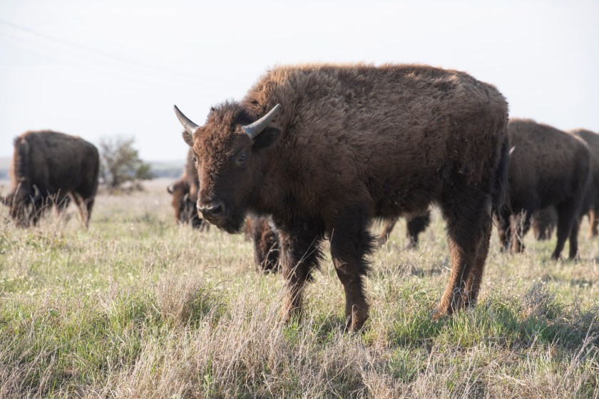
We pack up our site and hit the road to Osage Hills State Park which is not far from The Tall Grass Prairie owned and managed by the Nature Conservancy. Here they have bison with free range across the site. They are still fenced in at the property borders but otherwise travel across the landscape. We’ve been here in the past and look forward to exploring it more.

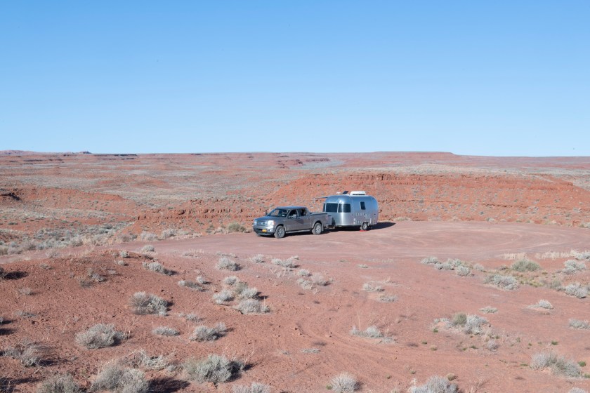
There are 20 RV sites with maybe half of them filled when we arrive. We’re here for three nights and we understand all the sites are filled for the weekend. This State Park is just over an hour from Tulsa and it’s an escape from being cooped up in the city.

The afternoon of our arrival we head out to the Tall Grass Prairie to view the Bison. We drive for a few miles and see none then some way off in the distance away from the road.  Then we crest a hill and the view reminds us of Lamar Valley in Yellowstone National Park and the “Buffalo Jams.” Buffalo are next to the road and in the road. This happens a few more times and we enjoy our views.Buffalo 1

Buffalo 2

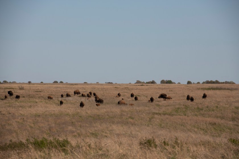
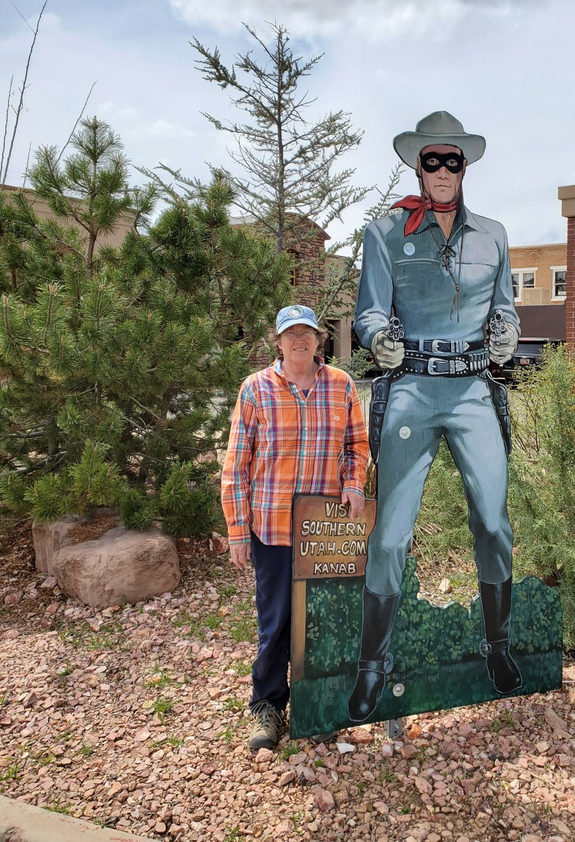
On the way back to the State Park we stop in Pawhuska and pick up some barbeque takeout for dinner which we thoroughly enjoy back in our camper.  One thing that is missing on this trip is eating out. With all the restaurants closed this is only the fourth time we’ve done take out. First time was the Adobe Deli, Deming, NM with Anna; a dinner and a lunch in Kanab, UT, and here.

Oklahoma is the only state that we know of that still has State Parks open for camping. You are required to make reservations online. Just showing up at the campground will not get to a site. It must be done online. When making the reservations there are 4 boxes that must be checked that you have read and understood the rules and requirements. One of them is to say you have read and understood “NOTICE OF MANDATORY QUARANTINE FOR CERTAIN PEOPLE TRAVELING TO OKLAHOMA FROM ANOTHER STATE, Executive Order 2020-13 ISSUED ON April 8 by the Governor of the State of Oklahoma. Wells read this on the website and checked the box. After our first night we notice a truck pull up to our campsite and stop, then continue on. We did not think anything of it. When we went outside taped on our door of our camper was the Notice of Mandatory Quarantine. They did not knock or say anything to us, just posted the notice. Are we quarantined? In rereading the Notice it is just informing us of the notice. The park employee put it on our door since we had out of state plates. They did not put it on anyone else’s door. We were profiled! We took the notice down and went about our day.

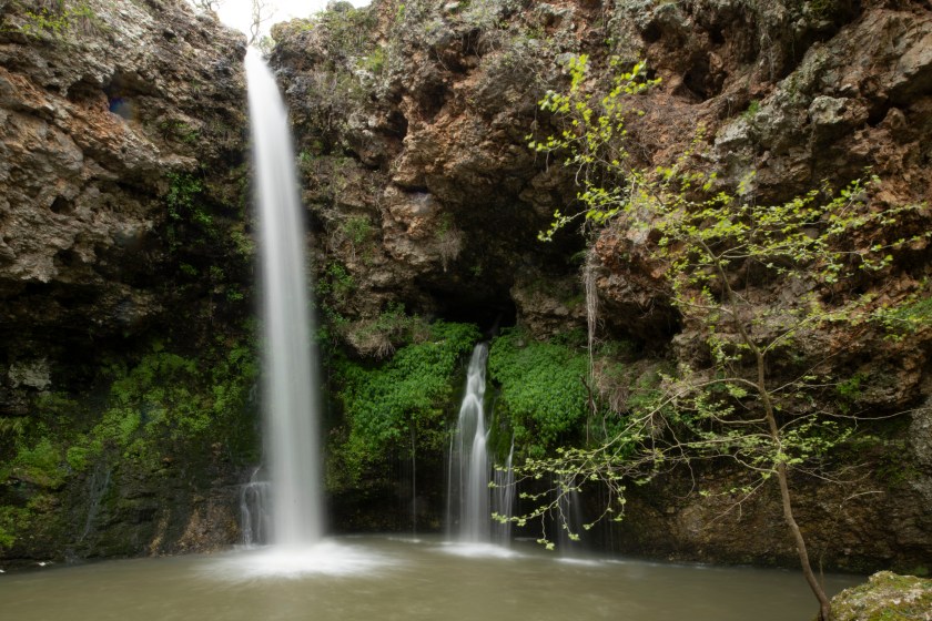
We first take a hike and again realize how poorly marked the trails are in all three of the state parks we’ve visited. Here they had signage at some of the trailheads with maps, but the signage was so badly weathered they were unreadable.

This afternoon is reserved for chores, laundry and groceries. We drive into Bartlesville and accomplish the tasks. The next day we do some longer hikes leaving enough time to find our way back incase we get misdirected due to the poor trail markings. We had a couple for really enjoyable hikes.

Another item missing on this trip are our interactions with other campers. Each socially distanced chat is short and sweet. Mark and Maggie walk by our campsite and we have a much longer and very enjoyable chat with them. They are from Tulsa and hope in a couple of years to do more longer trailer travels. They have a 50 year old restored vintage small trailer about the size or ours. We hope our paths cross in the future.

The next morning we pack up and head north. Our goal is to be close to Nebraska and Iowa yet still in Kansas. Iowa is one of the few states without a Stay at Home order but the Governor has closed all campgrounds. We hope to travel across Iowa to the Mississippi River since it is the only state west of the Mississippi and still in North America that we have yet to travel in with the trailer. Tomorrow we will see where we end up.

Robbers Cave State Park

As with Natural Falls State Park we are staying two nights at Robbers Cave State Park. We spend a couple of days hiking and avoiding crowds. We take the trails less traveled which is just about all the trails except the one directly to Robbers Cave itself. It was here that various outlaws would hide in the 1870’s and 1880’s. This included Jessie James.

The trails are poorly marked and the maps are drawn with the same skill level. Thus figuring out where a trail heads takes some guesswork.

It’s at this state park where we see how differently each state park is managing this crisis. At Natural Falls the bathroom in the campground was open while other campgrounds in the park were closed. Here the campground which is considerably larger than Natural Falls has one bathroom open from 9 am to 8 pm. All other times it is locked. In the restroom building they have 4 showers but only one of the showers is open. The other 3 are closed. As a result the park has about 50 campsites, one bathroom with one toilet for men and one for women. Add to that there is one shower to be shared by men and women.

The trailhead to the cave is a four mile drive from out campsite so we pile into the truck and go the trailhead. It’s as this point we find the trailhead crowded with parked cars. We park and determine there is a considerably longer hike that does not head to the cave and does not have anybody else on it. That’s the hike for us. On the finally loop the trail comes close to the cave and travels through “The Stone Corral” where outlaws kept their horses hidden.

20200415_141752
The Stone Corral

Natural Falls State Park – Oklahoma

Overnight the rain stops and the skies clear resulting with the temperatures again dipping down below freezing. Sleeping in the camper while the camper temperature drops into the forties is very restful as we remain warm under a pile of blankets. At daybreak we turn on the heat to warm our camper up from the low 40’s to above 60. Once the cabin warms we are up and enjoy our morning coffee followed by a hot breakfast.

After breakfast the skies again cloud over which pleases Wells since on the to do list is photograph the waterfall. Waterfalls are much easier to capture on cloudy days verses sunny ones. We hike down to the base of the falls staying on an elevated platform. The whole platform moves slightly whenever anybody walks about. This makes photographing the falls more difficult since Wells uses a tripod and long shutter speeds to capture the flowing water. After several photos we head back to the camper where we leave the photo equipment.

Without the burden of the photography stuff we head out to hike a longer trail and enjoy having the park almost to ourselves. On the trail we see only one other person and that was when we were at the end of the trail.

Now back the trailer Wells begins editing his photos. They are of poor quality due to the slight movement of the tripod on the shaky observation platform. Even with the poor photo quality the falls are beautiful so he posts the photos in spite of the quality.

Dripping Springs Natural Falls landscape mode 2
Dripping Springs / Natural Falls

Back to Oklahoma

Overnight the have a few rainstorms and at one point some pea size hail. Hail that size does not do damage so we are pleased it’s not larger.

We have a friend, Lee, who is exploring much of the United States searching and photographing waterfalls. We first met Lee while he was ticking off the waterfalls in upstate NY. He stayed with us for one night and was both a delight and a huge help. Anyway, back to now. While we were in western Oklahoma Lee sent us a message suggesting we check out a few Oklahoma waterfalls. Oklahoma and waterfalls are not what we associate with each other so we are thankful for Lee’s ideas. One, Natural Falls, is in a State Park just a few miles south of Kansas and a few miles west of Arkansas. It’s the perfect location to escape the pending bad weather. To our surprise Oklahoma State Parks are open to camping.

On our dash to avoid the weather we arrive at the campground and set up just prior to a few thunderstorms visiting us. Nothing severe but enough for us to stay sheltered in the camper and talk about how pleasant it is to have our retreat from the storm in tow.

Quivira National Wildlife Refuge

Our municipal park stay is $8 which includes water and electric. It’s a sweet small place to hang our hats for the night. It’s complete with a large pond protected by three pairs of nesting geese. Gee, a lot like home.

After fueling up at $1.49 a gallon we head south the 25 miles to the National Wildlife Refuge. There are two sets of protected wetlands in the area, Cheyenne Bottoms Refuge to the north and Quivira National Wildlife Refuge to the south. Both are good birding spots but the interesting thing is they can attract different birds. Cheyenne Bottoms is a freshwater wetlands area while Quivira is saltwater wetlands. We’ve birded both places in the past but today we decide to spend our time with the saltwater wetlands. Here we are in the middle of Kansas within over twenty thousand acres of refuge including 7,000 acres of saltwater marsh.

We drive the several miles of refuge wildlife drives and see American Avocets, Blacknecked Stilts, Blue Wing Teals, Northern Shovelers, a Loggerhead Shrike, White Pelicans, Cattle Egrets, Snowy Egrets, Great Blue Herons, Meadow Larks, Greater Yellow Legs, Lessor Yellow Legs, American Coots, a Falcon ( not sure if it is a Prairie Falcon or a Peregrine Falcon but will id later via photograph), and more.American Avocet 1Black Necked Stilt 2Black Necked StiltIbis 1Loggerhead ShrikeSnowy EgretFalcon 1Falcon 2

A storm and associated cold front will be here tomorrow so by midday we are headed south to avoid snow and temperatures in the low twenties. Our trailer is okay down to the mid-twenties but we neither want to winterize the trailer now nor risk damage to the water systems due to freezing.’

At the end of the day we pull into a RV campground in the southeastern corner of Kansas.

Onto the Heartland of Kansas

We are underway in the morning from New Mexico, passing through the Oklahoma Panhandle and into Kansas. We’ve been debating our route as we head more or less homeward. We’ve considered heading much further north into Nebraska and Iowa but looking at the weather forecast there is a strong cold front and associated winter storm headed across Colorado, Kansas, Nebraska, Iowa, and South Dakota with snow and lows close to 20 degrees. The storm will be upon us on Sunday into Monday. Weather like that can be a bit dicey.

With the information we have we make a plan. We are heading to the middle of Kansas to a large National Wildlife Refuge on Friday and going birding there on Saturday morning. Saturday afternoon we will then head south and east to avoid the worst weather.

After leaving Clayton we head into Oklahoma with the first town being Boise City. We stop for gas. Wells pumps the gas then remembers Boise City is the home of Ginger. We met Ginger a year ago while staying at an Oklahoma State Park and very much enjoyed meeting her. Wells decides to send a quick message to Ginger letting her know we are passing through town and we are thinking of her and her family. Two minutes after he sends the message Ginger replies that she and her husband were driving past a gas station, saw a pickup and small Airstream with NY plates. They actually wondered if it was us. It is a small world! Maybe someday in the future we will pass through Boise City and meet up with Ginger and her husband.

Onward we head northeastward towards the middle of Kansas passing miles and miles of irrigated farmland and at times large numbers of wind generators.

Tonight we are camped in a municipal park where we can explore the National Wildlife Refuge in the morning.

Across Northern New Mexico

Wells takes off early with the truck leaving Marsha and the trailer in place. He gets to the oil change place and does not even need to get out of the truck. He is back at the campground in less than 30 minutes. Mission Accomplished.

Today we’ll head more or less due east across the top of New Mexico following smaller two-lane roads the whole way. Our route takes us almost due east across the northern edge of New Mexico and includes two significant climbs with the highest one topping out within a few hundred feet of 11,000 feet in elevation. At the pass there is plenty of snow and much of it still fairly deep. Summer will not get here any time soon.

The only larger town we travel through is Taos, NM. Everything about Taos is unique. It’s a mecca for artists with many galleries. It’s a ski town unlike almost any place else we’ve traveled through.

As we continue our trek eastward along the small by-ways there are often surprises. For Wells today we pass Philmont Scout Ranch in northeastern New Mexico. Going to Philmont was the dream of many Boy Scouts with it being “the” scouting adventure. Wells never had gone, but a close friend of his, Billy, did go. Hearing Billy’s stories of his hiking adventures while at Philmont captured Wells’ attention and envy. Billy was a longtime friend who lost his life in a tragic fall while on a training cruise on a large sailing ship the summer after his Freshman year at New York Maritime College. Passing Philmont Scout Ranch today surfaced a flood of special memories.

We stopped for the night at an almost empty RV Park in Clayton, NM only a few miles from Oklahoma.

Four Corners

We enjoy a wonderful sunrise. Normally, we have our blackout curtains all closed when we hit the hay but last night we left them open to enjoy our privacy along with the moonlit night. In the morning we are treated to a charming sunrise. After exploring Valley of the Gods we head toward the Four Corners area where Utah, Colorado, New Mexico, and Arizona meet. It’s the only place in the United State where four states meet at a single point. The actual spot is in a Navajo Tribal Park and all of the Tribal Parks are closed. Our backroads route did take us through all four states but not the exact point where they meet.

The landscape changes rapidly in these parts. One moment we are driving past massive and colorful rock formations and ten minutes later we drive through non-descript land. The constant is there are not many people. On Navajo lands people’s homes are often widely scattered across the landscape often miles apart from other dwellings otherwise people live clustered in small towns.

Not knowing how available RV campground are in these parts since many are closed and just about all park campgrounds both State and Federal are closed we call ahead to a RV Campground in Bloomfield, New Mexico for reservations. When we arrive at the campground they are having us check-in using the after hours method therefore it does not entail interacting with any people.

We pull into the campground in the afternoon and once the trailer is setup for the night we head out to find a place to have an oil change. The one place in town that does them is open Monday, Tuesday, and Thursday due to Covid19. It’s Wednesday so they are closed. We’ll come back in the morning.

Kanab to Valley of the Gods

Heading out in the morning we travel to Page where we fuel up and head east then north. Our route takes us through Monument Valley where there are many iconic scenes from movies shot here. The Navajo Tribal Lands are closed so we cannot go off the beaten path. We don’t even know if the highway that travels up Monument Valley is even open but we take our chances. It’s open and we enjoy the amazing view from our truck. One stop we make is where the scene from Forrest Gump where Forrest has been running for three years and has a pack of followers running behind him. He stops, turns around, and says, I guess I can stop now.

Run Forrest Run - Monument Valley
Run Forrest Run

Further up the highway out of the Valley we stop for the night at a boondocking site in Valley of the Gods. Wells has been here before and saw several boondockers. Today we see none.

Valley of the Gods Campsite
Boondocking in Valley of the Gods

It’s a full moon tonight so Wells sets up to capture the moonrise from next to our trailer.

Moon Rise at Valley of the Gods'
Moonrise from our Campsite

Remaining Time in Kanab

Our plan is to head out from Kanab and begin our journey east. As long as the going is easy and we can find services we will take our time if things are more difficult we will make a run for home. We complete several small tasks and manage a long walk around Kanab before heading out the next morning. Laundry gets done along with a few minor repairs. We also do a major clean out of the truck.

20200406_140446
Many Westerns were filmed in the Kanab area – Marsha social distancing with the Lone Ranger