Dawson City, YT to Eagle Alaska
Today’s venture is along the Top of the World Highway, a road westward from Dawson City that connects Dawson to Alaska. Route is pretty much from Dawson City to Chicken, Alaska. I’m not sure how truthful the story goes but the town wanted to call itself Ptarmigan after the Willow Ptarmigan that is so common around these parts. I know them from when I lived in the Fort McMurray area back in the 1970’s. In winter the white birds were everywhere. Continuing with the story it turns out that ptarmigan is a hard word to spell. I think back to my childhood where spelling was the only thing I ever failed in grade school. I say, “Mom, how do you spell ptarmigan?” I can hear her response so clearly, “Look it up in the dictionary.” I would have never found it! To avoid this hazard they named the town, Chicken. Before I get to Chicken, let me go on about the Top of the World Highway.
I’ve heard about the highway for years and assumed it was so named since it skirts the northern reaches as far as roads go of the Yukon and Alaska. It was built long before the Pipeline road to the North Slope and the Dempster Highway to the Artic Ocean in extreme northern Yukon. Rather the Top of the World Highway heads along the top of the mountains with amazing long long views to both the north and the south, with some of those coming at the same time. The road climbs to well over 4,000 feet with the valleys right around 1,000 feet elevation. For the 100 miles or so there are no services or anything else except for the Border Crossing. What surprised me about the border crossing was that it was one building shared by both Canada and the United States.
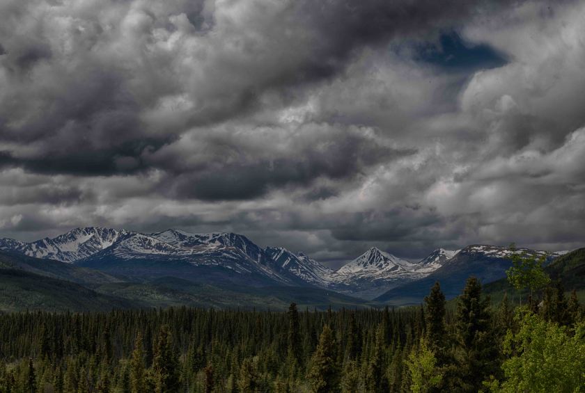
Top of the World Highway between Dawson City and Chicken Alaska
After crossing into Alaska we noticed a turn off to Eagle, Alaska. The turn off was roughly 62 miles north on the Richardson Highway. A gravel road that in many places there is room for both northbound and southbound vehicles at the same time. Yet there are many places along cliffs and deep ravines that there’s room for only one at a time. Road not recommended for larger RV’s. Good thing we are a smaller one! We’ve yet to make it to Chicken (probably tomorrow) as we are camped at a BLM Campground for the night. Eagle sits on the Yukon River downstream from Dawson.
Once setting up at the campground we hopped on our bikes and headed to town. First stop, the BLM Information Center where we met Cindy and Randy both employees there. It’s didn’t take long at all to establish that Randy is good friends with Mike and Andy, owners of Gilligans Island back in Sherburne. When in the area he often stops and explores the Rogers Center.
